|
|
 10-07-2019, 07:07 PM
|
#1
|
|
Senior Member
Join Date: May 2017
Posts: 201
|
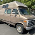
17 Days In Nevada, Northern CA and Oregon
Part 1
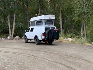
This was our first big trip with the completed van. The plan was to go west from Utah on highway 50 (The Loneliness Highway in America) to Great Basin National Park. From there we will continue on highway 50 to Lake Tahoe. From Tahoe we plan to continue northwest to Lassen Volcanic National Park and then further north to Crater Lake National Park. From there we will head north to Astoria, Oregon. At that point we will turn south and go down the coast of Oregon, stopping at the beaches and lighthouses. We will continue down the coast into California and visit the Redwood State and National Parks. From there we will turn east and work our way back home.
Great Basin National Park
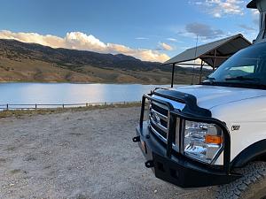
We got a late start from home. By 6:30 pm we found a place to camp near the Utah/Nevada border. There was a turnoff that we took on the north side of the highway and drove out about a mile to a nice spot in the sand and cedar trees.
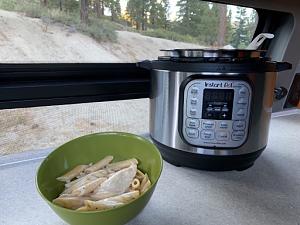
For dinner Eva tried her new small InstaPot. She cooked barbecue chicken and it took about 25 minutes. It also used about 20% of our battery power, but that should be made up in the morning with a few hours of the Nevada sun.
It was a very warm night so after eating we sat outside and looked at the stars. This area has no cities or houses close by, so there is no light pollution and so you could see a lot of stars. It was also a great night to sleep in our van. We opened all the windows on the top and had a nice cool breeze all night long. I think I had my best night sleep in the van.
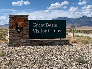
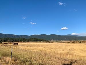
The next morning the drive to Great Basin National Park was about 30-40 minutes. The park headquarters are in Baker, Nevada. We stopped at the visitors center and learned a little bit about the park. We had a Lehman Cave tour at 1 pm, so we had some time to explore before the tour.
We drove the Wheeler Peak Scenic drive. This is an 18 mile drive that starts at 6000 elevation and ends at 10,300. We stopped at the scenic overlooks and campgrounds on the way up.


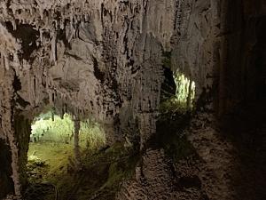
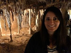
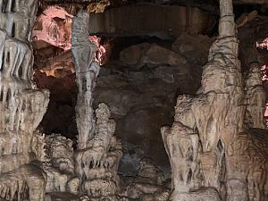
We met at the Lehman Cave Visitors Center 15 minutes before the tour and had an orientation meeting. The cave tour is about 0.4 miles long and takes about 1-1/2 hour. It was interesting and our tour guide was pretty entertaining. The cave was discovered about 130 years ago and for many years people would break off the formations to take home. The motto was If you can break it, you can take it. Once the government took over, better protections were put in place and the cave was better developed and controlled. There were man-made entrance and exit tunnels created to allow better access. The cave tour took you through 4-5 rooms that are open for public access.
We camped about 40 miles west of Ely a free campground overlooking Illipah Reservoir. It was another very nice evening with warm temperatures and not many bugs.
|

|

|
|
10-07-2019, 07:13 PM
|
#2
|
|
Senior Member
Join Date: May 2017
Posts: 201
|
Part 2
The next day was spent driving across Nevada on the Loneliest Highway. We camped west of Carson City in the mountains. There was a large sandy lot about 1.5 miles off the highway. We were there with 3 other RVs, but we never saw any of them during the time we were there.
We made another InstaPot meal. The Creamy Alfredo Chicken was pretty good. We ate dinner, cleaned up and then talked and read the rest of the evening.
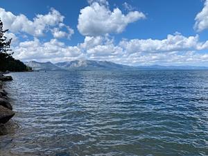
Lake Tahoe
We camped in the Forest Service campground just west of South Lake Tahoe City. We also walked through town and checked out the lake.
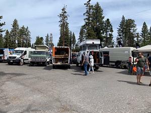
On Saturday and Sunday was the Adventure Van Expo at the Homewood Resort. There were probably about 100 vans on display, but most were built by professional builders.
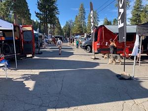

They also had a DYI van build contest. We entered our van, and ended up winning a Aluminess Expedition Kit.
From Tahoe were headed north along CA89 to Lassen Volcanic National Park. It was about 200 miles and we wanted to get close so we could get an early start in the park in the morning.
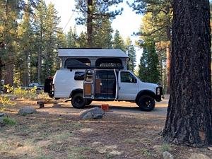
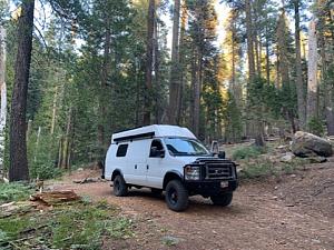
A few miles from the park we found a forest road that cut off the main highway. We followed it about a mile into the deep forest and found a nice camping spot next to a little creek.
After setting up camp, we used the InstaPot to make another delicious dinner.
|
|
|
|
|
10-07-2019, 07:18 PM
|
#3
|
|
Senior Member
Join Date: May 2017
Posts: 201
|
Part 3
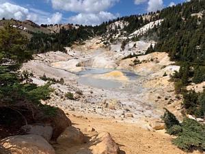
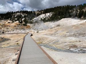
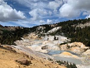
Lassen Volcanic National Park
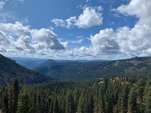
Our first stop at Lassen Volcanic National Park was at the visitors center. Lassen Volcanic National Park was founded in 1916, after Mount Lassen erupted in 1914. There is a scenic drive that takes you through the west side of the park to see the thermally active areas and other lakes and waterfalls.
We stopped on the road at a few sites and then around noon we started a 5.2 mile hike to Bumpass Hell area. This area was named after Mr. Bumpass after he broke through the thin earth crust and dropped both legs into a boiling hot mud pot. It was a pretty easy hike, but did get a little steep at the end as you climb up to the volcanic bowl to the mud pots and steam vents. They have a boardwalk so you can safely walk in the area.
We ate lunch at the rim of the bowl and then walked through the area. Overall it was about a 3 hour hike for us.

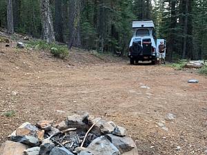
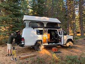
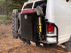
After the hike we continued on the scenic drive and stopped at a few of the areas affected by the 1914 eruption. We left the park around 5:00 pm and found a camping spot in the forest outside the park. We just drove along a fire road until we found somewhere nice to camp. After setting up, Eva hunted for pine cones and I mounted the ax and shovel set that I won on the back of the van.
|
|
|
|
|
10-07-2019, 07:24 PM
|
#4
|
|
Senior Member
Join Date: May 2017
Posts: 201
|
Part 4
Crater Lake National Park
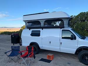
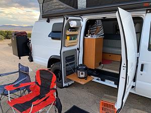
The drive from the Lassen National Part to Crater Lake National Park took most of the day. About a mile from Crater Lake we found another great campsite in the woods next to Annies Creek.
Eva made Bacon Ranch Chicken in the Instant Pot for dinner. It gets dark and cold around 7:30 pm, so after dinner we stayed in the van and talked and read the rest of the evening.
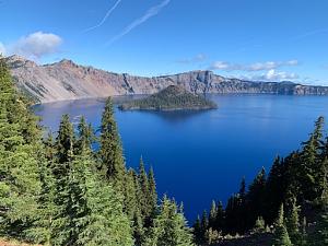
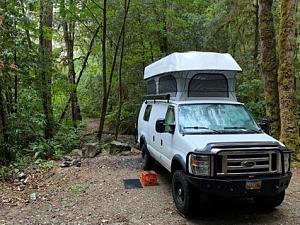
Attachment 1
Crater Lake National Park is the fifth oldest US national park. It was founded in 1902. The crater was formed 7,700 years ago, after the volcanic magma flowed out of the caldera beneath the volcanic peak. With no magma, the peak collapsed and created the crater. The crater was filled by rain and snow melt to create the lake. There are no rivers or streams that can bring silt into the lake. So the water is supposedly the cleanest lake water in the US. It is also the deepest lake in the US at 1,943 feet deep.
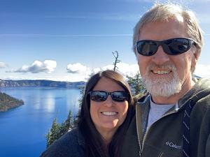
First we stopped at the Visitors Center and watched the movie about the park. It explained how the lake was formed. From there it is a 3 mile drive to the rim of the crater. This was our first view of the lake. We walked around the edge a bit and took pictures.

So we drove Rim Road to the viewpoints. About halfway around we arrived at the Cleetwood Cove Trail. This is the only way to get from the rim, down to the water. We didnt plan to do the hike, but just to walk down to the first or second switchback to get a better view. But at every switchback we kept going. Finally we accepted that we were going down all the way. The trail is only 1.1 miles each way, but is 700 ft of elevation change. So going down was not bad, but coming back up it was pretty steep.
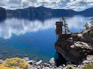
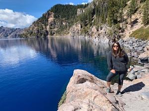
At the bottom there was a boat dock for the boat rides to Wizard Island. But they ended the boat tours for the summer last week, so we could not go for a ride. The lake water is the clearest water in the US, with visibility at least 100 feet.
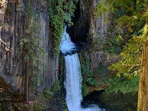
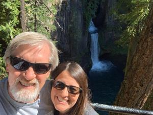
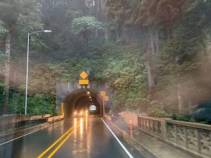
After the hike we ate lunch and left the park using the north entrance road. This started us towards the coast of Oregon. On the way we stopped and hiked to Toketee Waterfall. This was only about a 1 mile hike, but it was through a deep, dark and wet forest. It was almost like a rainforest. There were huge trees with moss and ferns growing everywhere.
|
|
|
|
|
10-07-2019, 07:28 PM
|
#5
|
|
Senior Member
Join Date: May 2017
Posts: 201
|
Part 5
Oregon Coast
From the Oregon mountains we headed north to the Oregon Coast. We made it to Tillamook and stayed the night at the Blue Heron French Cheese Company. They allow RVs to stay a night or two in their grassy field, among all their antique vehicles and farm equipment. After we cooked dinner, we went to their store and shared an ice cream cone. This is a popular place to stay, by the time it was dark, there were probably 20 vehicles parked for the night.
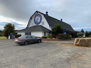
It was a nice place to camp. It was pretty quiet, but you could hear the highway a little bit through the night and morning. This morning the animals on the farm started making noise. They have a burro that started hee-hawing around 6:00 in the morning. It was also a very foggy and wet morning.

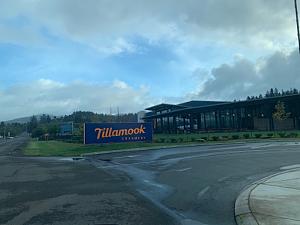
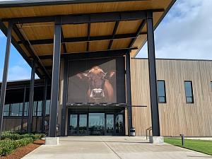
We left the Blue Heron French Cheese Company early in the morning. We wanted to get to the Tillamook Creamery just as it opened at 8:00 am. We went on the tour, sampled the cheese and browsed the gift shop.
From Tillamook we drove north on highway 101. This highway parallels the coast and bays of the Pacific Ocean. Its a narrow and curvy road, so you can never go very fast.
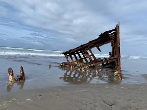
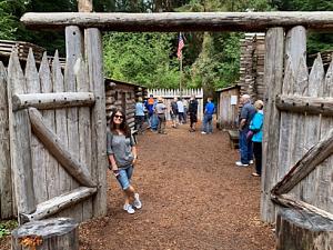
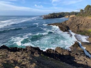
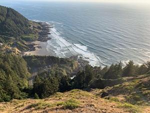
Our first stop was Ecola State Park. This had a high cliff overlook above the beach. We took some pictures and walked a few of the trails. The next stop was Fort Stevens State Park. The first stop was at the black sand beach with the remains of an old shipwreck. We walked the beach and ate lunch.
After lunch we went to the historic fort site of the state park. There were several old fort structures to walk through, and a visitors center with a movie about the history of the fort. It is the oldest military structure on the west coast of the US. It was built during the Civil War.


The next stop was Astoria Oregon. We went to the Astoria Column and climbed the steps to the top to admire the view and take pictures of the Columbia River and the surrounding sites.

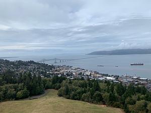
Our last stop for the night was the Astoria shoreline boardwalk. Not much was open, but we walked along docks and looked at the ships.
Our next goal was to find a place to camp for the night. The first two spots we had identified were fenced off by the lumber companies. But we found a spot in the forest about 10 miles east of Cannon Beach. It was another dark and quiet spot. We slept well and had another good night.
|
|
|
|
|
10-07-2019, 07:32 PM
|
#6
|
|
Senior Member
Join Date: May 2017
Posts: 201
|
Part 6
Oregon Coast
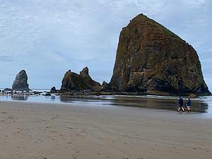
We left camp the next morning just before 9 am and were parked in Cannon Beach by 9:15 am. We parked in town, but then we had about a mile walk along the beach to the Haystack Rock. I think this is the most famous rock on the Oregon coast.

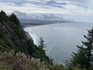
We continued south on highway 101, stopping at the overlooks and state parks.
Every night around 4-5 pm we start thinking about where to camp. We use the iOverlander app on our phones that show different campgrounds that people have stayed. It has a focus on free spots in the woods/deserts. That is how we have found most of our nightly campsites. However, sometimes the sites are either taken, or not a very good site. Other times, the description of the campsite and the path there are not very accurate.
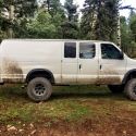
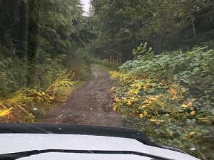
Tonight we had some problems getting a site, but in the end we still ended up at a great spot. We followed the iOverlander app to the first two sites we thought would work for us, but at the first the road was gated and the second site was essentially a spot on the side of a hill. We kept going deeper and deeper into the forest. The road got narrower and it got darker. Finally after about 5 miles on a forest road we found a spot at the bottom of a steep hill. The trail is covered in loose shale, so we will probably need 4WD to get up and out of our spot. But its still a great spot and we will not have to worry about anyone bothering us.

|
|
|
|
|
10-07-2019, 07:39 PM
|
#7
|
|
Senior Member
Join Date: May 2017
Posts: 201
|
Part 7
After 12 days of excellent weather, the rain started pouring in the night and pretty much rained all day. Between the rain and the fog, it was a pretty gray day.
We woke up early and left camp. We were camped about 5 miles down a narrow steep road. I was a little worried about getting up the muddy road, but with the van in 4WD Low, it was no problem.
We continued down the Oregon coast, and stopped at several overlooks and state parks, but it was so rainy and foggy, it was hard to get any good pictures.
We crossed the border into California around 5 pm and started looking for our campsite. We picked a spot on the Smith River, about 15 miles from Crescent City. It was a paved road all the way, except the last 1/2 mile. We turned off the highway and drove down a narrow steep road until we were near the river. It was still raining hard, so I put on my rain coat and leveled the van. The rest of the night we stayed in the van. For dinner we heated up some leftovers in the microwave.
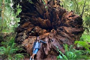
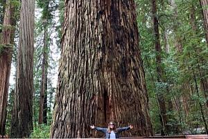
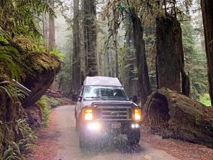
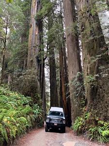
The next morning we went to the Redwoods visitor center in Smith River Canyon. The Redwood National and State Parks are made up of 4 separate parks they do share some borders, but are mostly spread down 50 miles of the California coast. We started in the Jedediah Smith Redwood State Park. This park has a lot of old-growth coastal Redwoods. Many are hundreds of years old and are up to 300 feet tall. We went on several hikes through the redwood groves. After hiking we drove the van down a narrow dirt scenic route through the park into Crescent City.
The best option for camping was near the area where we camped the night before, but not on the main road. We went down a side road and found an open gravel pit area to camp. It was nice to be in an open and sunny area. It allowed us to raise the camper top and dry things out.
By the time we found out campsite, it was around 5 pm. This is early compared to the other nights. We ate dinner and relaxed the rest of the night.
|
|
|
|
|
10-07-2019, 07:45 PM
|
#8
|
|
Senior Member
Join Date: May 2017
Posts: 201
|
|
|
|
|
|
10-07-2019, 07:51 PM
|
#9
|
|
Senior Member
Join Date: May 2017
Posts: 201
|
Part 9
Homeward Bound
The next morning we started our way home, but plan on taking 3 days to get there.
We drove on highway 299, east from the coast, to Redding. The drive was through more forests and hills. The highway followed the Trinity River. It is a very beautiful area. We stopped at a river beach to eat lunch. I drove down close to the river and got the van stuck in the sand. It was not too bad, I just put it in 4WD and drove out of the sand.

We ended up camping near Lassen Volcanic National Park. The spot was only 1/2 mile from where we camped the previous week. The rain continued through the night, so we were stuck in the van for the evening.
The next morning we continued through the California forests, but as we got closer to Nevada, the terrain turned to more open space and sagebrush. We continued east on I-80. Around 5 pm we stopped at a campsite in Water Canyon, just 4 miles south of Winnemucca. Even in Nevada it was raining off and on, so everything was wet and muddy when we set up camp. We spent the evening reading in the van.
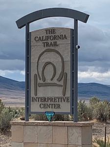
In the morning we left camp around 8:30 am. We continued to drive east on I-80. We made a stop at the California Trail Center that is outside of Elko. We were there for over an hour. I was surprised at how nice this place was and the number of exhibits about all the trails that went west.
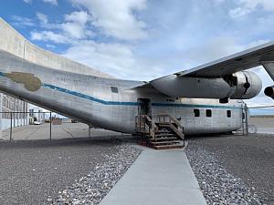
We pulled off at a desolate off-ramp in Nevada to eat lunch and then were back on the road. Our next stop was at the Air Force Museum in Wendover, UT. This is the location where the Enola Gay was stationed when they were training for the drop of the atomic bombs in Japan.
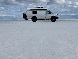
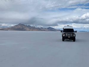
Our final stop was at the Bonneville Salt Flats, just east of Wendover. I have never been there, so we drove a few miles out on the salt to experience the rock, hard salt surface.
From there it was about 2-1/2 hours to get home. We had no problems for the final leg of our trip.
Our trip was 18 days/17 nights. We drove 3150 miles through 4 states. We ended up paying for 4 nights at campgrounds (mostly to get access to showers), but the rest of the nights were free. We visited 5 national parks and a few monuments and state parks.
|
|
|
|
|
10-07-2019, 10:36 PM
|
#10
|
|
Senior Member
Join Date: Apr 2007
Location: SF Bay Area, CA
Posts: 1,289
|
Looks like a nice trip. I remember seeing your van at Homewood resort. Nice build.
__________________
Phil
- 2005 EB50 6.0PSD - SMB 4x4
|
|
|
|
|
|
 Posting Rules
|
You may not post new threads
You may not post replies
You may not post attachments
You may not edit your posts
HTML code is Off
|
|
|
|
 » Recent Threads
 |
|
|
|
|
|
|
|
|
|
|
|
|
|
|
|
|
|
|
|
|
|
|
|
|
|
|
|
|
|
|
|
|
|


 Linear Mode