The storm has been moved up and now looks to impact the area beginning Thursday afternoon.
MODEL TRENDS HAVE SPEED UP THE ARRIVAL OF THE COLD FRONT. IT NOW LOOKS LIKE EARLY FRIDAY MORNING WE SHOULD SEE MORE STEADY PRECIP EXPAND ACROSS THE NORTHLAND WITH SNOW LEVELS AS LOW AS 7000 FEET FOR AREAS WEST OF A LINE FROM PAGE TO PAYSON.
I'm riding this afternoon and for sure on Sunday if anyone wants to tag along. Sunday should be warm and dry.
__________________
2005 E350 RB 6.0 PSD for extended fun
1989 Landcruiser FJ62 for local fun
2011 VW TDI Golf for hwy fun
My sister lives in Flag, so I'll be flying in (SMB stays home in NY) and staying with her. Definitely looking forward to chatting with other owners about all things SMB.
__________________
Brienne of House Duramax
2008 GMC LMM Duramax w/ Quigley 4 x 4
____________________________________
"I can see the concrete slowly creepin',
Lord take me and mine before that comes."
- Lynyrd Skynyrd
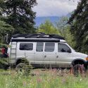
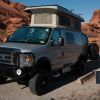
All loaded up...Heading south after work tomorrow with my pint sized sidekick, Gage and hope to make it down toward Coral Pink Sand Dunes and crash somewhere for the night. We hope to roll in Fri am at some point and we'll be there thru Sunday afternoon with some friends and their kids from Park City. Planning on Valley of the Gods Sun eve then roll thru Moab and home Mon night. Hope to meet some y'all down there. Fridge is stocked with some tasty IPAs and a bottle of High West....
Safe Travels All
-derek


 Adobe Loon (aka the Dawghaus)
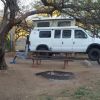 The Yeti
 Jiminy
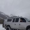 Agnes
Agnes

 Linear Mode