Over the New Years holiday I did the Mojave Road/Trail. The route was a good one and better than expected. Trying to find a few other members to do the run fell through but I understand how difficult it is to get away for a camping trip at that time of year so it was a one vehicle trip. My buddy Don from Merced had gone with me in 2012 to do the trail but we got rained out. He was ready to try it again so at least I had a navigator. This is a short version of my trip report from my web site. For a more detailed look at the Mojave Trail go
Here
The trail is about 130 miles long and the route is usually started from the Fort Mojave side close to Needles.
After picking up our personal rocks on the Colorado River, it was decided Fort Piute was our first stop for the night.
The trail didn't require four wheel drive at first but there were some steep sections.
Besides Fort Piute there are a handful of waterholes that were used by early man and those who used the trail.
We got in at night after traveling up the short rocky spur off the main trail.
Morning with a nice view
The next day it was off to Lanfair Valley.
It was a bumpy ride back down to the main road and up the Piute Range.
Lanfair was flat and easy going.
The old bus seemed like it should be at the Barker ranch.
Some of the trail is tight.
Other parts are canal like.
Another night run to our next camp the stone cabin at the Caruthers Canyon turn off.
I wish we would have had time to go up the canyon but time was short.
The next stop was another watering hole called Rock Spring.
It was another army outpost at one time.
Very close by was another rock house.
This one is protected by the park service.
Again not far off was yet another watering hole called Government Holes.
This spot had been in use during the 20th century.
After crossing a paved road, the trail dropped into a unique valley and began to climb.
Our next camp was on the other side of these mountains.
This was a nice camp and could hold several SMB's with room to spare.
Probably out best meal.
Filet Mignon wrapped in Beacon, Stuffed Shrums, Couscous, Quiche, and bread.
The next day we were off toward Marl Springs.
Another old army outpost and water hole.
The trail started another climb.
It was fairly steep but not enough to engage the 4x4.
Over the hill was one of the more unique stops.
The Mojave Mail Box. Where were those magnetic Forum stickers

And right next to it:
The FROG SHRINE!
Next stop was the best camp spot of the trip the Volcanic area.
Had a nice little fire here.
Bad spot if it was raining though.
Off to the great soda lake and the travelers monument.
Here you're supposed to drop off your rock, then climb to read the plaque.
Travelers are not supposed to reveal what is on the plaque.
The soda lake should be avoided in wet weather.
Lots of dust driving this.
Again the sun was dropping before getting to camp. Crossing the last mountain range took us into the dune area. Very difficult to navigate, here four wheel drive was worth having.
In the morning we could see where we were at.
Next and final area was Afton Canyon.
This is sometimes called the Grand Canyon of the Mojave...slightly smaller scale though.
That is really water during a drought.
After driving out of the riverbed the trail followed the RR tracks.
The first water crossing.
And finally the second.
Afton Canyon CG was right around the corner. This was the end of the trail.
My web site post is more detailed and shows the route we took in 2012.
Overall this was a great run. I just wish we had more time to visit some of the many sites off the trail. Next time I'd like to take much more time and hopefully get a few more members to do this route with me. The weather was reasonable where daytime temps were in the upper 60's and nights cold enough for a fire. Wind at times was hard to get out of but drinking in the van wasn't an issue at all

Dave
BTW the picture below just magically put itself here and is a glitch but a nice glitch.
Hey Don WAKE UP!


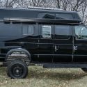
 Sportsmobile (AKA Money Pit)
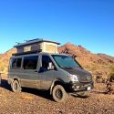


 Linear Mode