|
|
 06-24-2020, 08:32 PM
|
#1
|
|
Senior Member
Join Date: Jun 2016
Location: New Mexico
Posts: 261
|
New Mexico Backcountry Discovery Route
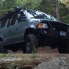
The entire route:
 Day 1
Day 1

I met up with Jimmy and Suzie (Jimmyrig) from Prescott, AZ, and their pup, Luna, in Las Cruces. The plan was to motel it there that night (Monday), and then slab it to Dell City, TX in the morning to start the offroad route. When I got the motel, they were already there. Problem – a check engine light had come on in their van on the way to Cruces. Jim had a code reader, and it seemed to be a problem with the DEF system, but didn’t appear fatal. In fact, the light was intermittent, and so they decided to continue on, hoping they wouldn’t get the dreaded Sprinter “countdown.”
Tuesday morning we headed off to Dell City, and got there about 11 A.M., a little later than expected. Google Maps said it was about a two-hour drive, and it ended up being three-ish. Dell City is not exactly rich in colorful history. The town was founded in the late 1940s, when an aquifer was discovered underneath. This allowed for the cultivation of about 40,000 acres of previously desert land. Over the years, the population grew, peaking at almost 1,000, but only about 400 residents remain there today.
Fuel up, air down, and we’re off! A couple miles up the road, there’s a cattleguard and barb-wire fence. It’s the TX-NM border, no sign or anything, just a fence.

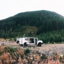
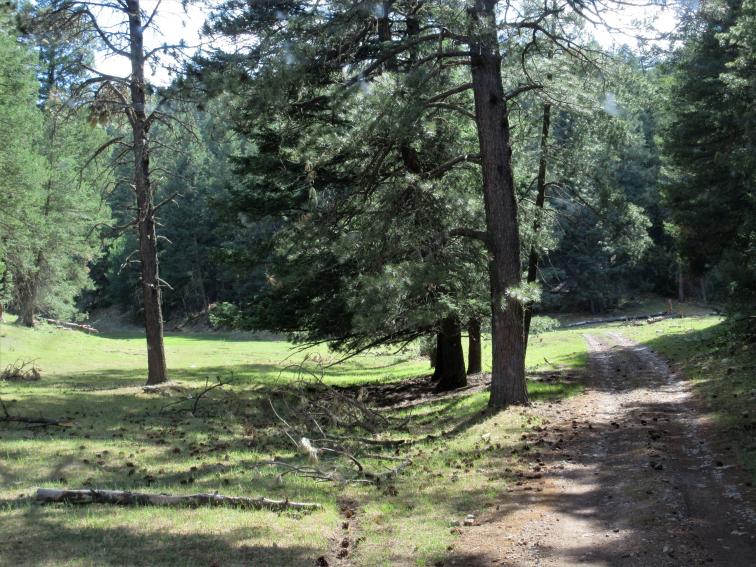
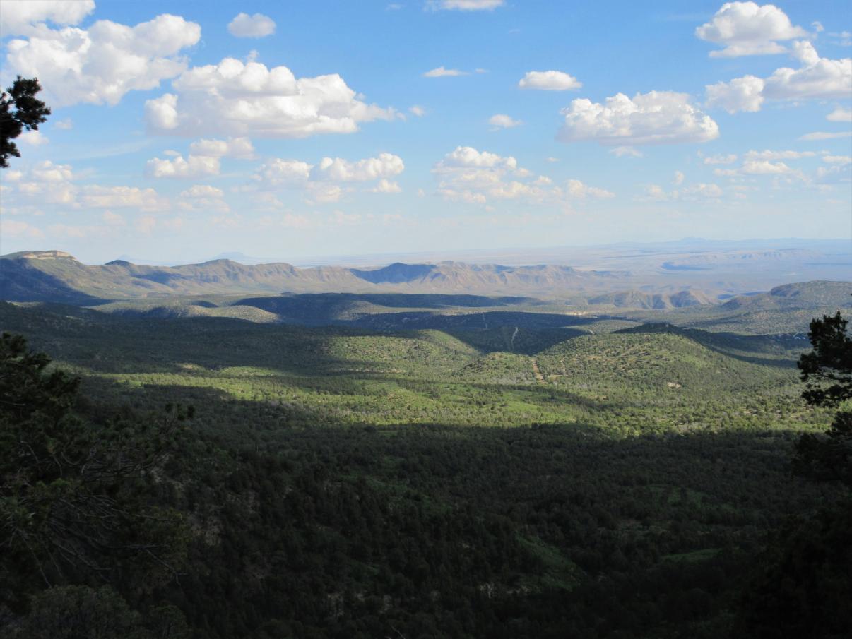
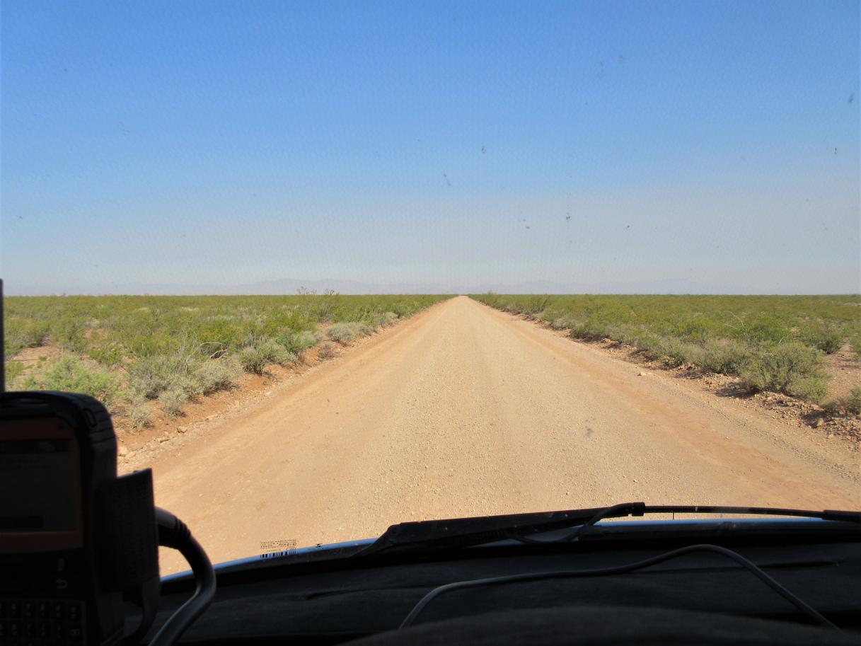
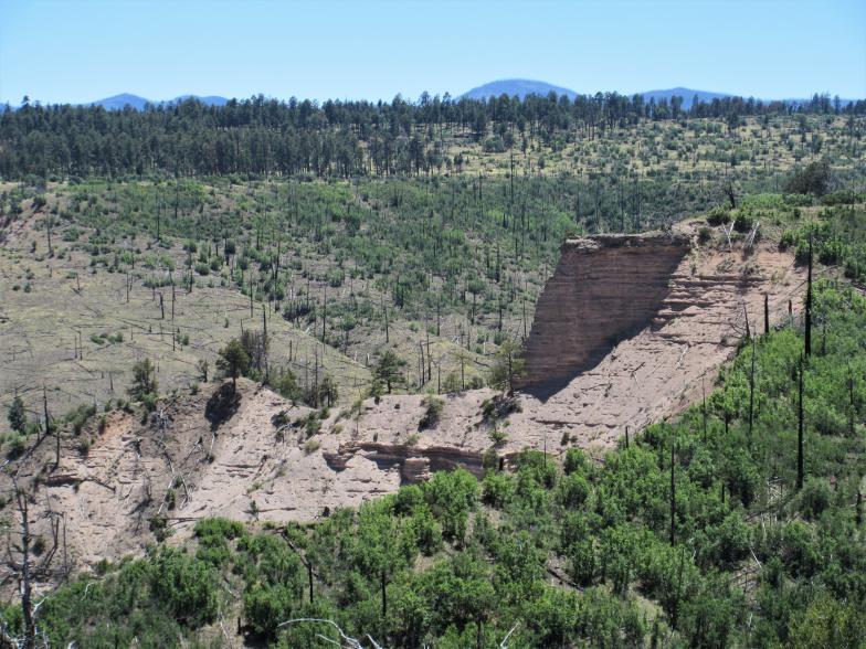
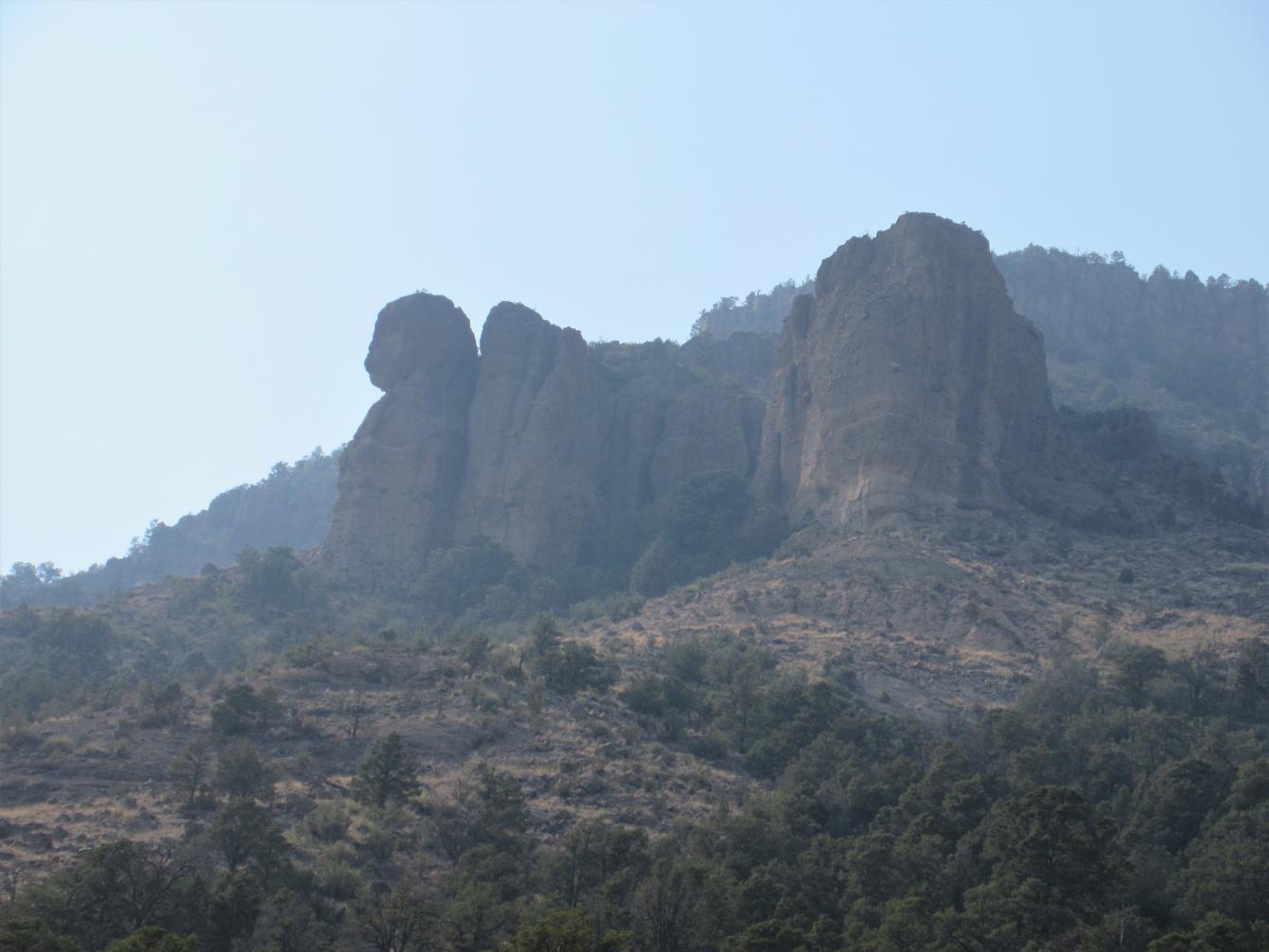
The first 130 miles is flattish desert with relatively good roads. Then the route enters the Lincoln National Forest and tips up to the Guadalupe Rim, a 1,500 to 2,000 foot high scarp with incredible views to the West. The rim is part of a giant Permian reef that was formed about 250 million years ago, buried in sediment, and later uplifted into what we now know as the Guadalupe Mountains.
Guadalupe Mountains National Park, just south of the border, is home to the 4 highest peaks in Texas. The reef formation is the same one that contains Carlsbad Caverns National Park to the East as well. The road winds along the rim through the pinon-juniper scrub along the rim for several miles, before dropping back down into the desert.
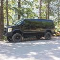
The desert section lasts not long, though, and soon we climb up into the Sacramento Mountains, first into P-J, and then into the pines. The route passes by the Bluewater Lookout, built in 1917, and quite possibly the oldest in the Lincoln NF.
Our next fuel stop was the Weed Store in Weed, NM in the Agua Chiquita Canyon. Weed was established in 1885, but there was trapping, ranching, and hunting activity in the area prior to that date. The town was named not because of the surrounding flora, but rather after a prominent merchant from White Oaks. Although W.H. Weed probably never visited the area, he set up a store at a crossroads there, and others settled around it. At one time, about 1,000 people called Weed home. Now the population is down to a mere 20.
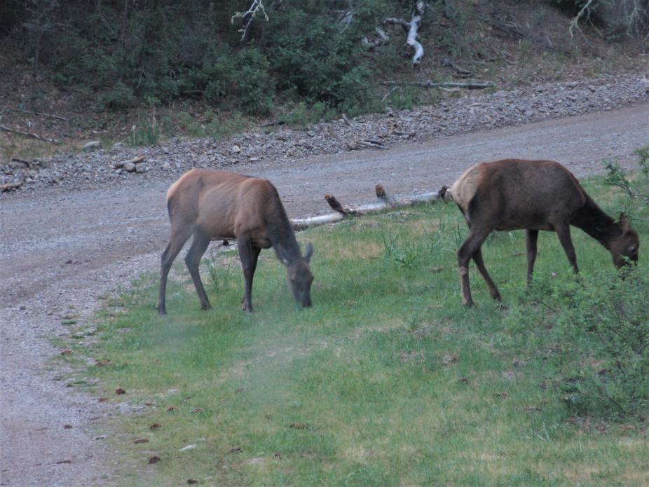
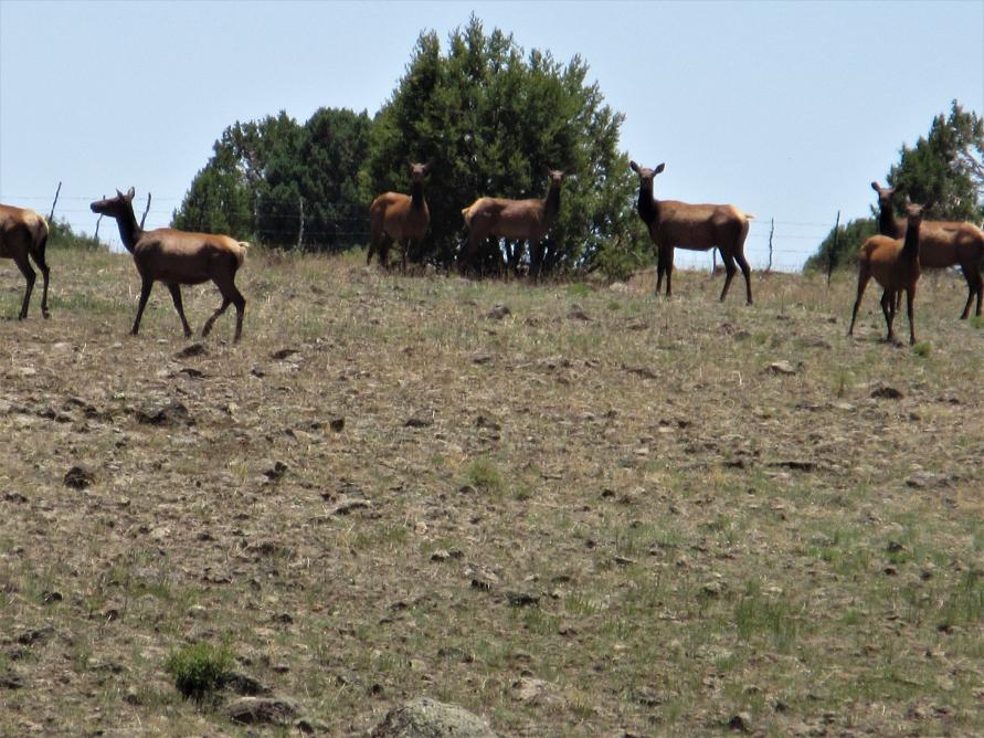
Winding our way up the small valleys past Weed in the late afternoon, we saw several elk, deer, and a coyote hunting some sort of small prey.

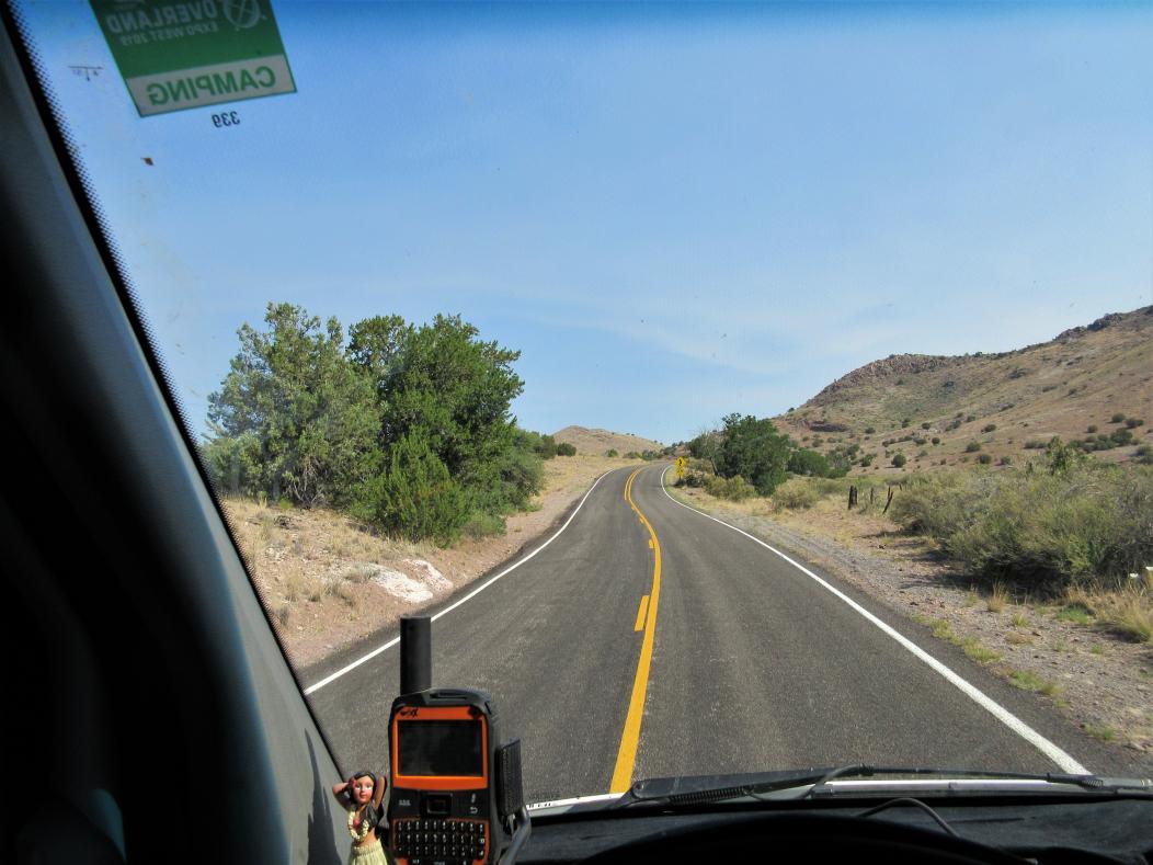
Then we were out into the P-J on West Side Road, high above Alamogordo on our way to High Rolls. On the peaks high above the road are the Sacramento Peak Solar Observatory and the Apache Point Stellar Observatory in Sunspot, NM. A side trip to Cloudcroft and Sunspot would be nice, but the timing wasn’t right for us.
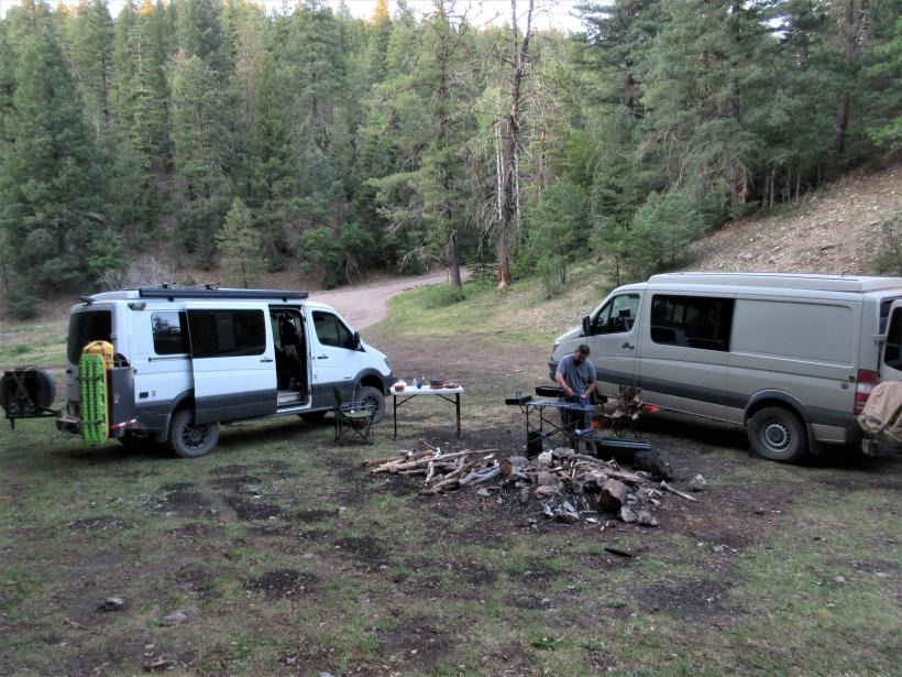
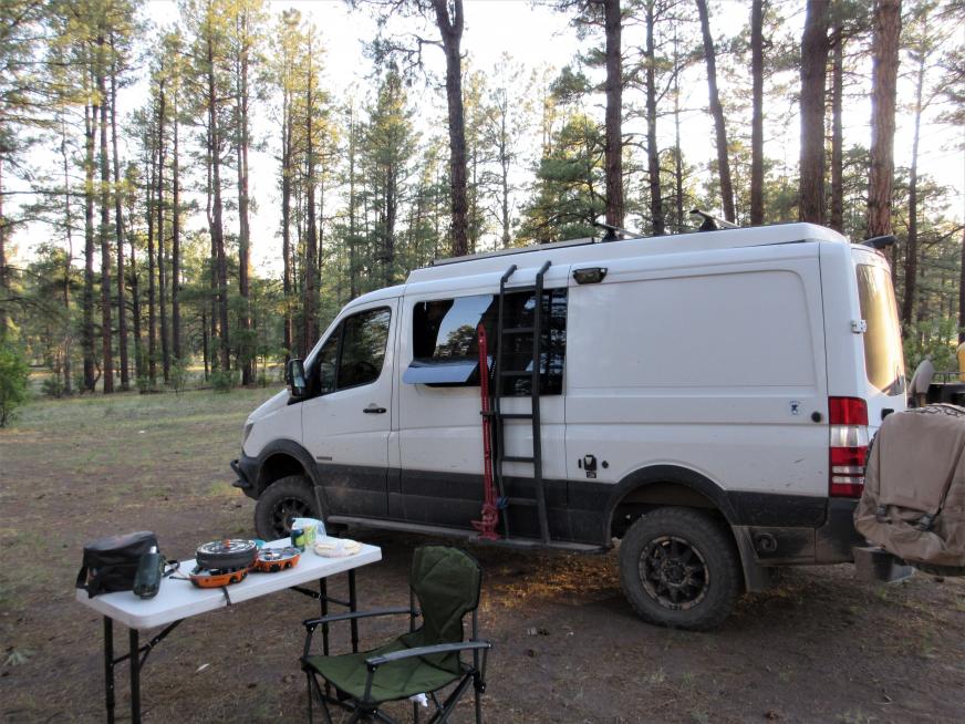
We continued on to High Rolls, founded in the 1880s and birthplace of Pulitzer Prize-winning wartime cartoonist Bill Mauldin. The first store, built in 1905, is still standing today. We decided we were not going to make it to Ruidoso before dark, and continued a few miles up into the NF and found a campsite for the night.
It was a long day. Total miles for the day, including the drive from Las Cruces to Dell City, was about 345 miles.
__________________
W3TAX
WRDZ686
2016 4wd 144" Sportsmobile Sprinter
2019 Chevy Colorado ZR2
2002 lifted & armored WRX wagon (sold)
|

|

|
|
06-25-2020, 11:40 AM
|
#2
|
|
Senior Member
Join Date: Nov 2016
Location: FL and VA
Posts: 1,952
|
Nice trip report, looks like a great trip. Thanks for posting.
Any part of the NMBDR not doable by van?
__________________
Chris
2008 GMC 3500 Quigley Weldtec 4x4 Savana SMB
|
|
|
|
|
06-25-2020, 01:00 PM
|
#3
|
|
Senior Member
Join Date: Jun 2016
Location: New Mexico
Posts: 261
|
We did the whole thing. We bypassed 2 expert sections, one by Reserve and one by Abiquiu. We did this because we didn't know what the roads were like and some moto writeups indicated they were pretty difficult. My van has a lift, skidplates, and is on 31s. Jim & Suzie's van is on 33s.
__________________
W3TAX
WRDZ686
2016 4wd 144" Sportsmobile Sprinter
2019 Chevy Colorado ZR2
2002 lifted & armored WRX wagon (sold)
|
|
|
|
|
06-25-2020, 01:21 PM
|
#4
|
|
Senior Member
Join Date: Jun 2016
Location: New Mexico
Posts: 261
|
Day 2

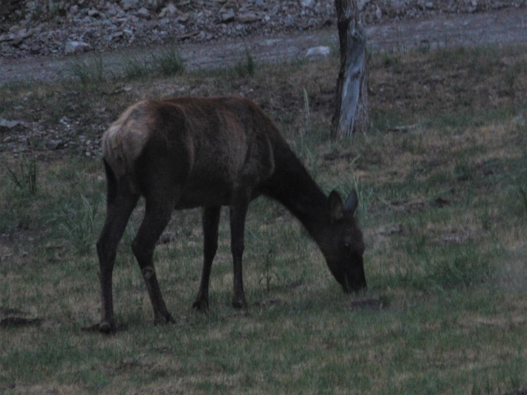
This Wednesday morning I got up just before 6 A.M. and puttered around in the van, getting dressed and setting up my coffee. I looked out the drivers side window and there are 2 cow elk grazing in our camp!

The traveling day began with some narrow rocky trails through the pine forest, and then a descent back into High Rolls.
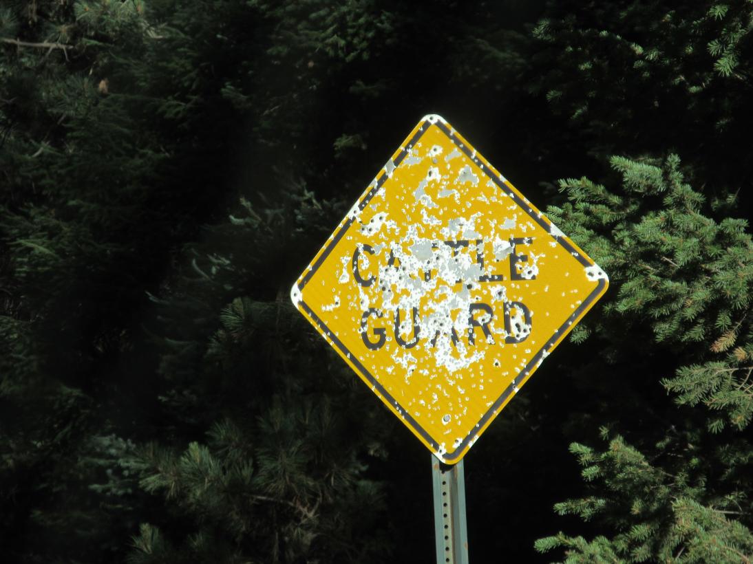
Road signs here take a beating out here.
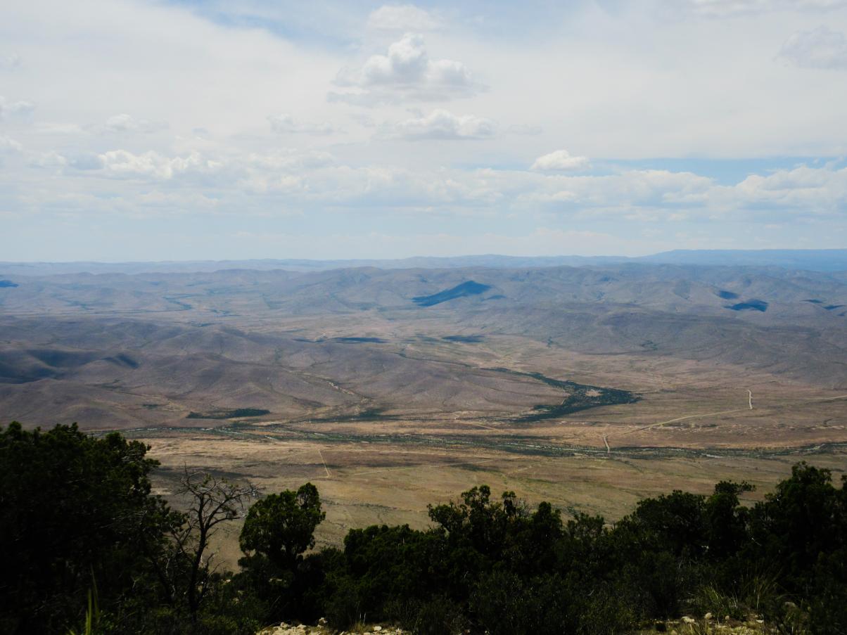
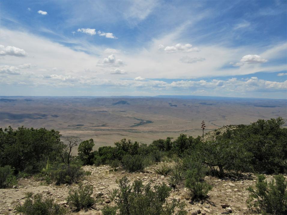
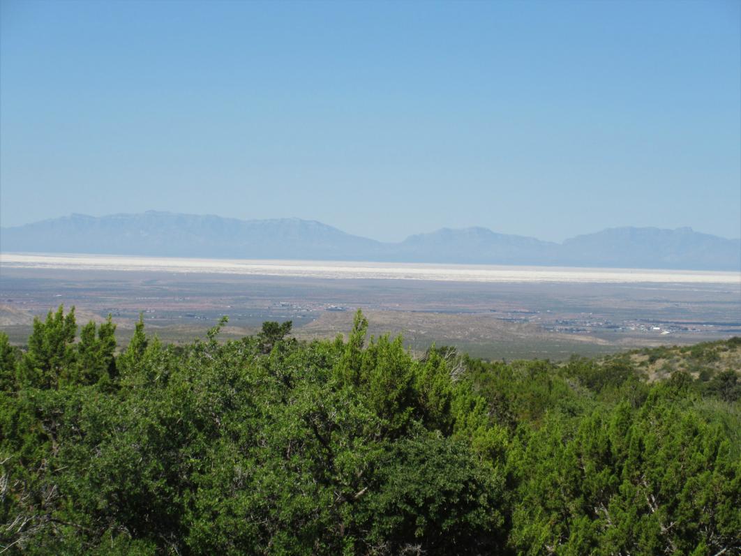
The route continues to drop into the desert of the Tularosa Basin. That's White Sands National Park in the distance.
There it turns onto the highway for what was expected to be a 40 mile run to the area around Ruidoso. We aired up and rolled up the highway. At Mescalero there was a large sign saying that all Mescalero Apache Tribal roads were closed. We stopped at the turn-off to assess, and by chance ran into a tribal official who confirmed that the Nation had experienced an outbreak and that we were not allowed on the off-road route to Ruidoso. We continued on pavement another 25 miles or so to Ruidoso, where we rejoined the route.
Ruidoso is at the foot of the 12,000 ft Sierra Blanca Peak. Native American ruins dating back to between 900 and 1400 AD have been found at the mountain. The Mescalero Apache consider the mountain to be the home of the mountain gods, their protectors.
The original name for the town was Rio Ruidoso, or noisy river, but the name was shortened sometime along the way. The current town dates back to about 1870, when the first building was erected. That building, Dowlin Mill, still stands today. In 1914, the first tourist cabins were built in Ruidoso. Others followed, and tourism took off with the building of the first ski-tow in 1938. The current ski area was opened in 1961. In 1963 it was purchased by the Mescalero Apaches. Ruidoso Downs is the home of the All-American Futurity, one leg of the Quarter Horse Triple Crown.
The route proceeds back onto to dirt outside Ruidoso, near Bonito Lake. The original dam was built by the railroad in 1907, and had a 132 mile wooden pipeline to provide water for steam locomotives at Pastura, NM. The current dam, built a little downstream, was completed in 1931. The lake was a source of drinking water for the city of Alamogordo, and a popular fishing and camping spot. In 2012, the Little Bear Fire and the subsequent monsoon rains filled the reservoir with mud and ash. It was drained and dredging and repairs began in 2015. The lake is still empty and work continues today.
From Bonito Lake we eventually dropped down to the desert floor and fueled up in Carrizozo, where I got my only Allsups burrito of the whole trip.
Carrizozo was established when the railroad put a station there in 1899. Carrizo is a grass which is excellent fodder for cattle. The extra zo denotes an abundance of such grass in the area. In 1909, it became the Lincoln County seat, sparking a legal battle that went all the way to the US Supreme Court. The towns population peaked at around 2,000 by 1920. With the decline of the importance of the railroad, the population has halved since then.
About 35 miles west of Carrizozo on the current-day White Sands Missile Range is Trinity Site, where the first atomic bomb was detonated on July 16, 1945. Carrizozo was the first town downwind of the explosion and received some radioactive contamination from the blast. The blast vaporized the steel tower on which the bomb was mounted, melted the sand around the tower forming a mildly radioactive glass called Trinitite, and broke windows 120 miles away. The blast was felt over 150 miles away. The 51,500 acre Trinity site was declared a National Historic Landmark in 1975 and is open for visits only twice a year, in April and October.
The route heads west on the highway out of Carrizozo, across a lava flow known both as the Carrizozo Malpais and the Valley of Fire. Shortly thereafter, it turns north into the desert and then west, roughly paralleling the highway. Along this section, we met a couple ranchers traveling the opposite direction. They surveyed the vans and told us they see a lot of motorcycles on the route, but no rigs like those. But, they said, it looks like youre well equipped, good luck to you and safe travels. Once back on the highway, we travelled west a little way towards San Antonio.
San Antonio can trace its history all the way back to 1629, but in recent times has been best known for being the home of great green chile cheeseburgers at the Owl Bar and the Buckhorn Tavern (now sadly closed). The Owl Bar was built by the Brunswick Balke Collender Company (youve probably used their bowling balls!). Prior to statehood, while New Mexico was still a territory, Conrad Hilton was born, the son of a merchant and hotelier in San Antonio. A.H. Hiltons original mercantile burned down about 1930, but the wooden bar was saved and later installed in the Owl Bar, where it remains today.
We turned off the highway just short of San Antonio. Once the route heads south through the desert, it follows the fenceline along the western edge of the WSMR. The roads were pretty good through this section all the way to Elephant Butte Reservoir and the town of Truth or Consequences, our destination for the day.
Originally developed as a test site for the V-2 rocket, WSMR is the largest military installation in the US. It covers almost 3,200 square miles, and is contiguous with the 900 square mile McGregor Range Complex at Fort Bliss, TX, and Holloman Air Force Base near Alamogordo. In 1982, the Space Shuttle Columbia landed at WSMR. Twice over the years, rockets either launched at, or launched toward, WSMR have veered off-course and exploded in Mexico.

Interestingly, on the road along the WSMR fence, my GPS acted very strangely, losing maps, turning off, and flip-flopping North and South. Other travelers of the BDR had mentioned this, but I didnt believe it until I saw it for myself.
This area, from Socorro south to Las Cruces/El Paso, is known as the Jornada del Muerto, or journey of the dead. The name was given by Spanish conquistadores, denoting the especially hot and arid journey between the two cities. During the Pueblo Revolt of 1680, more than 2,000 Spanish, Isleta, and Socorro Pueblo residents were forced south out of Socorro. Fewer than 1,200 survived the journey to El Paso. Now, we cross that territory in just a few hours, even off-road.
We saw quite a few pronghorn, or speed goats in this area. In fact, the route traverses the eastern edge of the BLM Pronghorn Wilderness Study Area just south of highway between Carrizozo and San Antonio. Pronghorn are the fastest land animal in the Western Hemisphere and second in the world behind the cheetah. Unlike the cheetah, though, pronghorn can sustain high speeds over long stretches. They can reach speeds of upwards of 60 MPH in full sprint, and can sustain 35 MPH over 4 miles. They have a 320 degree field of vision and their vision is said to be equivalent to a human looking through 8-power binoculars. Because speed and vision are their main defenses against predators, they inhabit the wide open, and are seldom seen in more forested areas. Although they have horns, not antlers, they do shed regrow the outer sheath of the horns each year. They are not antelope, although they are often called such. They are most closely related to giraffes and okapi.
In the late afternoon, we rolled into T or C and all the State Park camping at Elephant Butte Reservoir was still closed, so we got a motel for the night. The dam at Elephant Butte was started in 1911 and finished in 1916. At the time, it was the largest irrigation enterprise in the US, and holds the largest body of water in the state of NM. T or C is a town of about 6,500 residents. Formerly known as Hot Springs, the first hot springs bath there was built in the late 1880s. By the 1930s, there were approximately 40 hot springs spas, with a population of only 3,000 residents. Currently, there are about 10 spas in operation. Hot Springs officially changed its name to Truth or Consequences in 1950, when it was announced that the popular radio show would host its 10th anniversary show from the first town to name itself after the show.
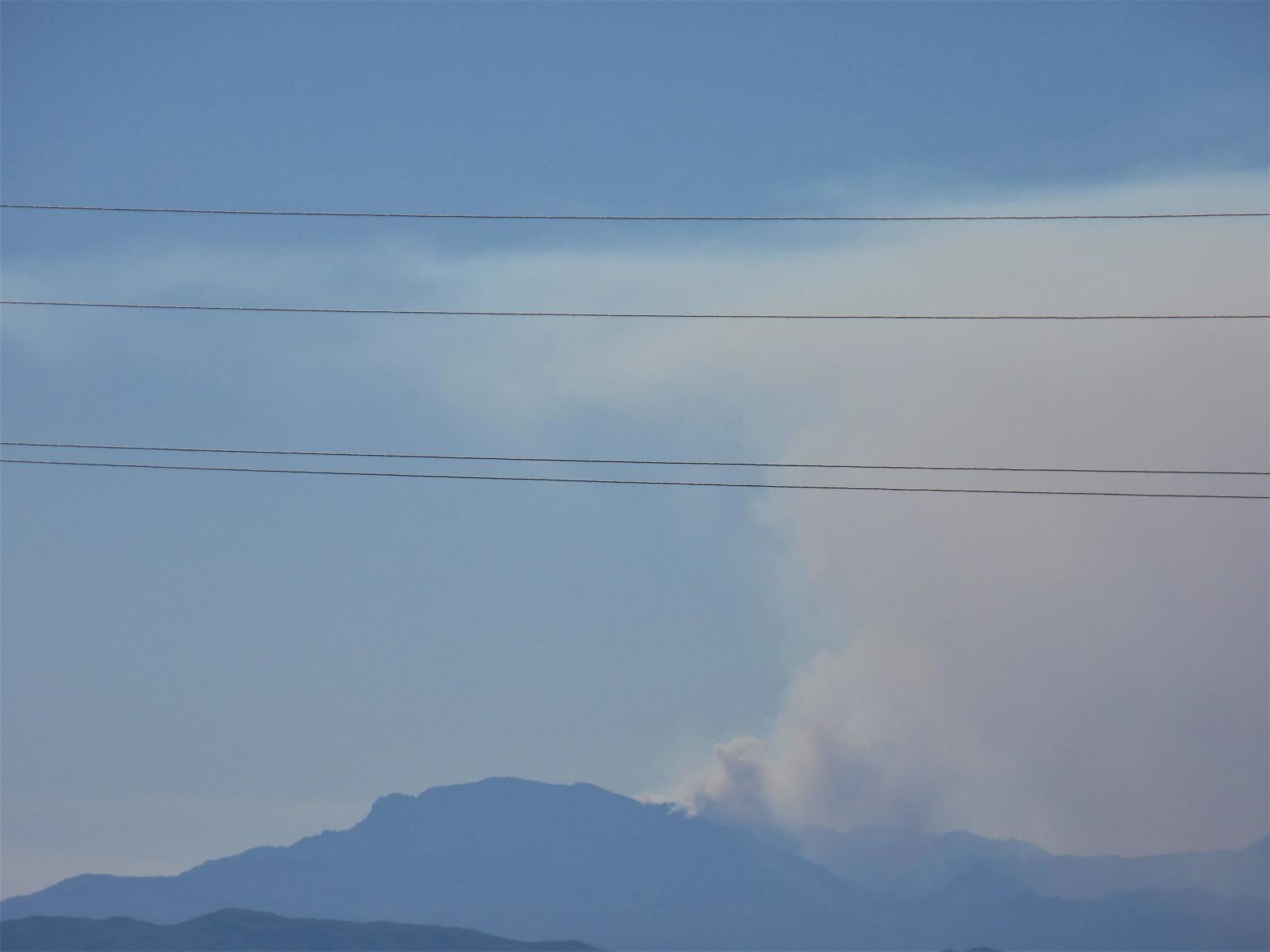
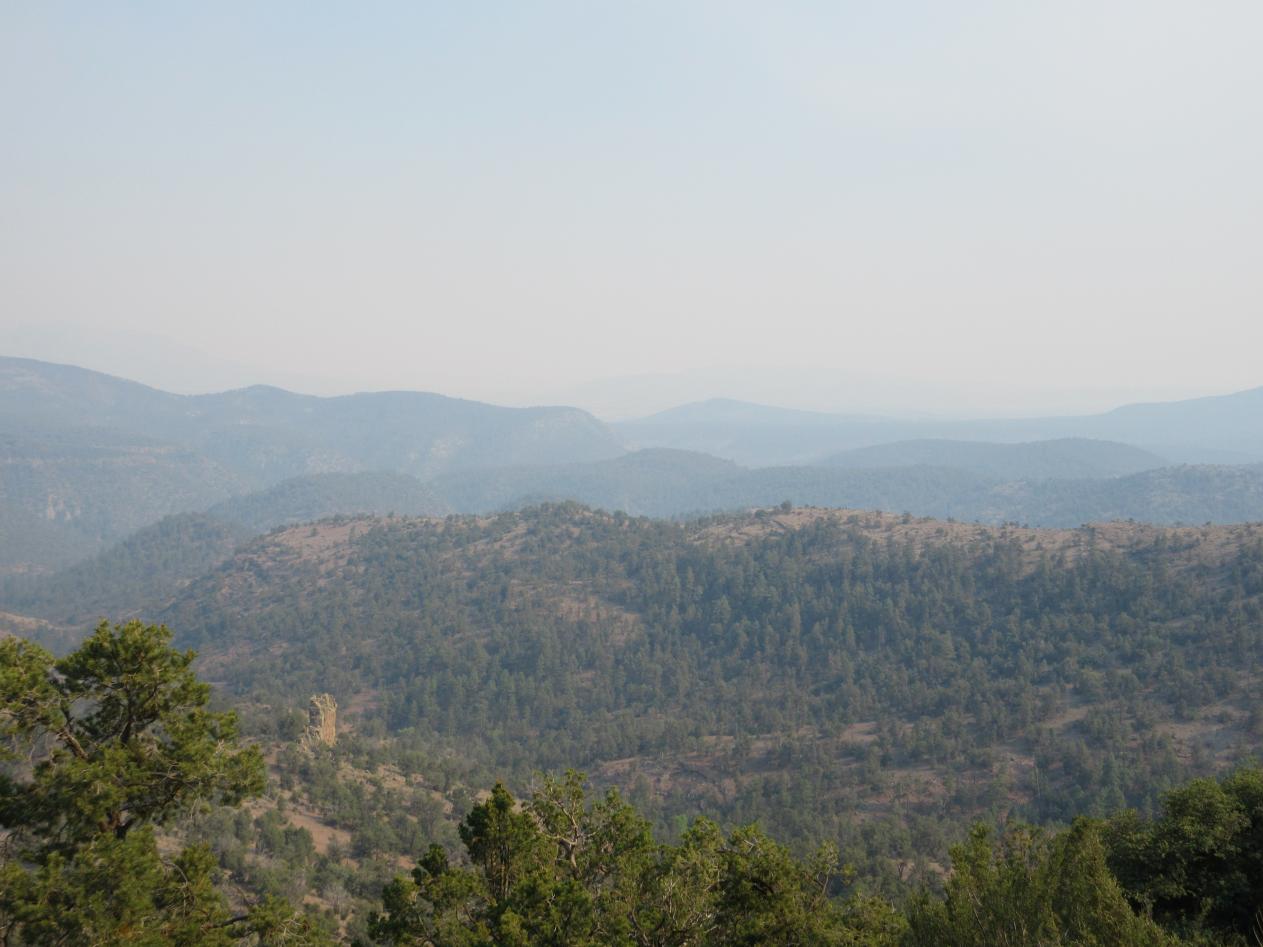
As we headed towards T or C, we could see the plume from one of the wildfires in the Gila National Forest. Hopefully the area to which we were traveling the next day would be unaffected.
Total miles for day 2 was about 260. After traveling over 600 miles in 2 days, we spent the night only 75 miles north of our starting point in Las Cruces.
__________________
W3TAX
WRDZ686
2016 4wd 144" Sportsmobile Sprinter
2019 Chevy Colorado ZR2
2002 lifted & armored WRX wagon (sold)
|
|
|
|
|
06-25-2020, 02:15 PM
|
#5
|
|
Senior Member
Join Date: Nov 2016
Location: FL and VA
Posts: 1,952
|
Quote:
Originally Posted by velo47

We did the whole thing. We bypassed 2 expert sections, one by Reserve and one by Abiquiu. We did this because we didn't know what the roads were like and some moto writeups indicated they were pretty difficult. My van has a lift, skidplates, and is on 31s. Jim & Suzie's van is on 33s.
|
Excellent, thanks.
__________________
Chris
2008 GMC 3500 Quigley Weldtec 4x4 Savana SMB
|
|
|
|
|
06-25-2020, 02:18 PM
|
#6
|
|
Senior Member
Join Date: Apr 2013
Location: Illinois
Posts: 818
|
GREAT TRIP REPORT!!!!!! The video of the 4x4/forest/trails were absolutely priceless! This gives members a real taste of what they will be up for and IF they think they can navigate sd destinations/adventures...I (personally) think that it motivates other members to 'use' their rigs to get to places where they didn't think they could go (fear of the unknown)...GREAT!
__________________
'13 MDX 'BigBlackmobeebs'
'01 Lexus 430 LS 'Luxobeebs
'20 Tacoma TRD OR 'Tacobeebs'
|
|
|
|
|
06-25-2020, 02:28 PM
|
#7
|
|
Senior Member
Join Date: Jun 2016
Location: New Mexico
Posts: 261
|
Thanks! They look flatter and easier in the videos! I think it's because the camera angle is always level, and the scenery tilts, instead of vice versa.
__________________
W3TAX
WRDZ686
2016 4wd 144" Sportsmobile Sprinter
2019 Chevy Colorado ZR2
2002 lifted & armored WRX wagon (sold)
|
|
|
|
|
06-25-2020, 02:41 PM
|
#8
|
|
Senior Member
Join Date: Mar 2015
Location: Maryland
Posts: 3,378
|
I too enjoyed your report Velo47! Always a fun read when members chronicle a recent trip (more so when loaded with pic's & video). Thanks
__________________
TwoXentrix
"AWOL"
|
|
|
|
|
06-26-2020, 06:13 PM
|
#9
|
|
Senior Member
Join Date: Jun 2016
Location: New Mexico
Posts: 261
|
Day 3

Thursday we left T or C about 8 AM, headed north along Elephant Butte Reservoir, and then west across the flat desert towards Winston.
Soon enough it got a little hillier and less arid, and a portion travels over the Geronimo Trail National Scenic Byway. The byway starts in the south at San Lorenzo, NM, and the north end is at Beaverhead Workstation, with T or C in the middle. We would travel to Beaverhead today, but mostly not on the paved byway!
We inquired at the Winston General Store about the fires and were assured our route was safe. Winston was formed in 1881 by miners who found the nearby town of Chloride too rowdy. The town was originally named Fairview. Frank Winston, a businessman, moved to town in 1882. He was one of the good guys, and often extended credit to customers who were down on their luck. When he died in 1929, the town was renamed in his honor. Winston was a silver mining town, and like many others, was essentially shuttered by the silver panic of 1893. A handful of residents live there now and Frank Winstons house and carriage house still stand, along with the 1890 schoolhouse and post office.
Off to the small town of Chloride, population 11. Chloride was founded in 1880, with the discovery of silver by Harry Pye. When times were rippin, Chloride boasted 9 saloons, 2 hotels, a general store, butcher, dry goods store, candy store, pharmacy, Chinese Laundry, photographic studio, newspaper, and a school. Just as with Winston, the good times only lasted until 1893.
Here we entered the Gila National Forest. The Gila NF contains 3.3 million acres, and several designated Wilderness Areas, including the first in the nation, the Gila Wilderness. The Rocky Mountains southern terminus is in the Gila, as is the northern terminus of the Sierra Madres. The area also contains Chihuahuan and Sonoran deserts, contributing to its diverse flora and fauna.
In the highlands of the Gila, evidence has been found that Paleoindians at least passed through the area between 9,500 and 6,000 BC. Also found have been remains of the Cochise Culture (6,000 BC 300 AD). The Mogollon, an offshoot of the Cochise, seem to be the first permanent settlers in the area, living in cliff dwellings and pit houses, and growing their own food. They appear to be the first to make clay pots, which reached its peak with the Mimbres people of the Mogollon culture. In the 1,200s the Mogollon disappeared, the reason for which is unknown. In the 1,500s and 1,600s the nomadic Apaches entered the area. They were hunter-gatherers who lived in tents and other temporary structures. In the 1,800s, the Spanish were mining copper in the area, and the natural resources were being heavily exploited. The area became part of the US in the mid-1,800s the Gadsden Purchase. In the late 1,800s the conservation movement was born, as some people realized that the plunder could not continue indefinitely. Aldo Leopold, among others, was instrumental in protecting the Gila Wilderness. In 1924, 755,000 acres of the Gila was finally set aside as the first designated wilderness area in the US.
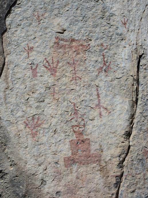
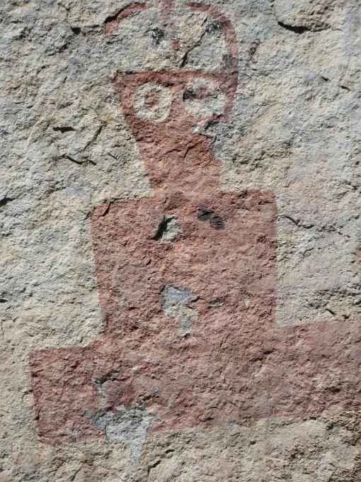
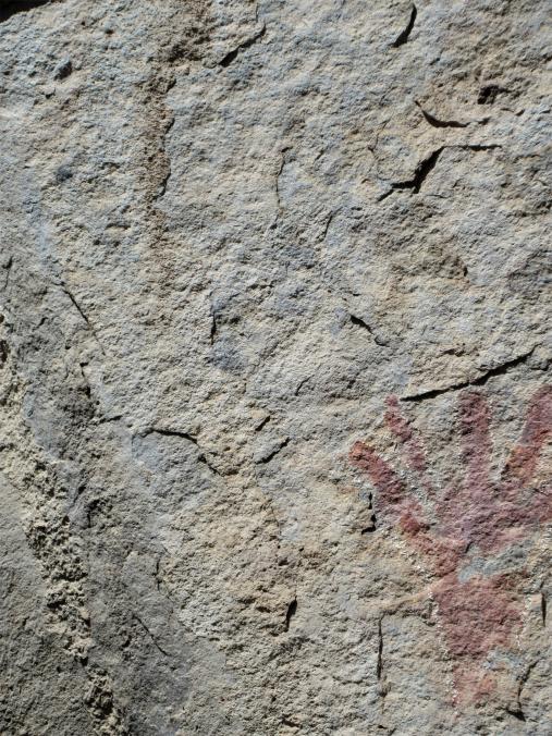
As we entered the Gila, we also entered Chloride Canyon, a narrow, steep walled chasm cut by what appears now to be a small intermittent stream. The road twists and turns, crossing the stream reportedly over 100 times. I believe it. There is a pavement bypass here, but we had no problem getting the vans through, other than a multitude of new pinstripes.
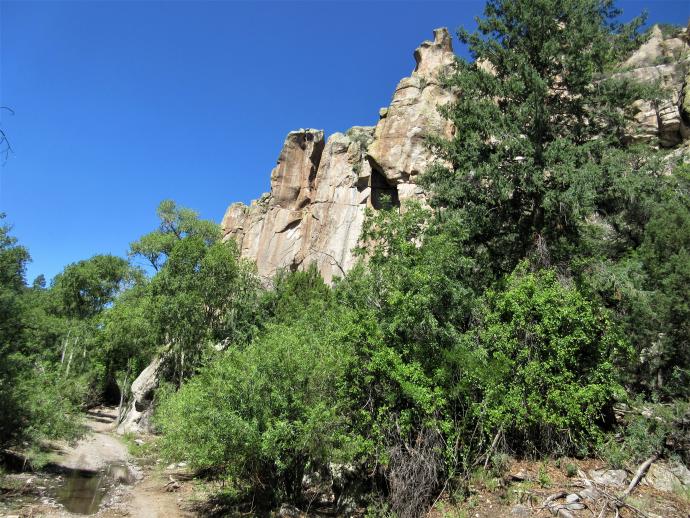
Part way up the canyon is a spectacularly overhanging rock, and just past that are a group of petroglyphs painted in red on the canyon wall, and scratched into the soot on the underside of a nearby overhang.
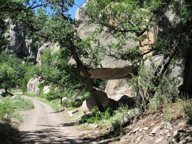

We then climbed out of the canyon and into pine forest and meadows.
Throughout the area there are remnants of abandoned cabins and other buildings. Here we saw several elk and deer.


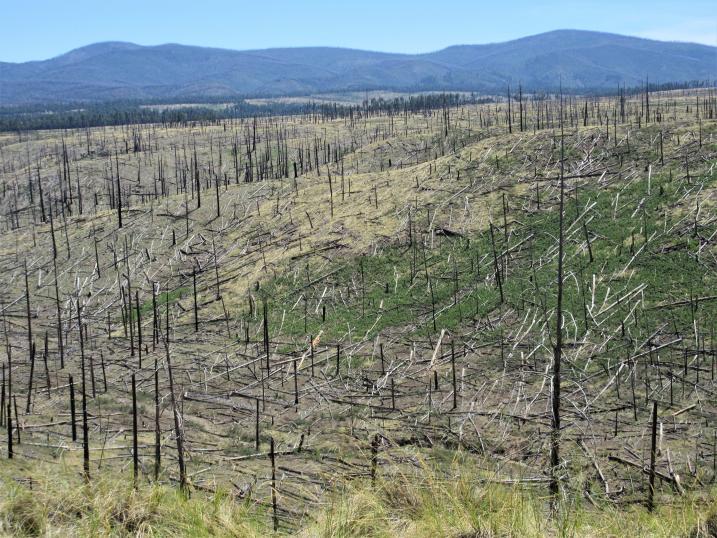
We went by the Forest Services Beaverhead Workstation and its associated dirt airstrip, then by Snow Lake, through the remnants of a big burn (the 2018 Buzzard fire, I think), and down into the town of Reserve around 5 PM.

Reserve is the county seat of Catron County with a population under 300. In the 1860s, Mexican-Americans established a string of villages along the San Francisco River, creatively named the Lower, Middle, and Upper San Francisco Plazas. When Anglo settlers arrived, they renamed Upper San Francisco Plaza as Milligans Plaza, later to become Reserve, NM.
Here, in 1884, Elfego Baca arrested a drunken cowboy named Charles McCarty, to the chagrin of McCartys compatriots. A shootout ensued in which one cowboy was killed. The Justice of the Peace ordered a nearby rancher to bring Baca in for questioning. A standoff ensued, and the rancher was killed. The cowboys retaliated, and allegedly fired over 4,000 shots into the house where Baca was holed up. Baca escaped unscathed, but he killed 4 cowboys and wounded another 8. Baca was tried on 2 counts of murder and was acquitted, even though now it appears he was never legally deputized. Later he became the Socorro County sheriff, and in 1888, a US Marshall. He then became a lawyer and politician both before and after New Mexico statehood in 1912.
In Reserve we would fuel up and split up, with Jim and Suzie going to Albuquerque to get the van looked by the dealer, and me continuing on the route. I continued on, turning just inside the AZ border, to the village of Luna (there is no gas in Luna any longer).


Luna is home to about 150 residents. The post office there was established in 1886. It was briefly a hideout for outlaws, but in 1883 was settled by Mormon ranchers. The town is named after Don Salomon Luna, who owned the lands prior to the settlement. Mormon Pioneer day is still celebrated in the town each year.
I camped for the night in the pines just north of Luna. This section of the trip was extraordinarily smoky due to the wildfires in SW NM and in AZ. Total mileage for the day was a wonderful 225, over 800 total, and we were still not halfway up the state!
__________________
W3TAX
WRDZ686
2016 4wd 144" Sportsmobile Sprinter
2019 Chevy Colorado ZR2
2002 lifted & armored WRX wagon (sold)
|
|
|
|
|
06-26-2020, 08:12 PM
|
#10
|
|
Senior Member
Join Date: Jan 2009
Location: Boulder, CO.
Posts: 2,554
|
Thanks for the detailed report, these routes have been on our radar for sure. Just curious, and I may have missed it, Ive seen the paper maps that can be ordered up, but what map program did you use to route this out, google maps? And all the area info? Just googled or did you get some books.
Ive just downloaded the Gaia app and upgraded to the full version, I know theres a lot of features I have to explore, including all the available maps, but not sure the BDR as a standalone are available on there and I dont know if I can import. I know theres a few other sites where they can be downloaded. Thanks, sorry to slightly derail.....
__________________
'03 Ford E350 7.3L Diesel
(de)SMB'd Custom RB-50
Quigley 4X4 w/Deavers & Agile Offroad's R.I.P. package
CCV High Profile Pop Top
|
|
|
|
|
|
 Posting Rules
|
You may not post new threads
You may not post replies
You may not post attachments
You may not edit your posts
HTML code is Off
|
|
|
|
 » Recent Threads
 |
|
|
|
|
|
|
|
|
|
|
|
|
|
|
|
|
|
|
|
|
|
|
|
|
|
|
|
|
|
|
|
|
|


 PigPen
 2008 GMC 3500 SMB
 Sportsmobeebs, Sporty for short
 AWOL
AWOL

 Linear Mode