Quote:
|
Originally Posted by daveb
I wonder why the ICSD said they would ticket me if I went around the signs. Scare tactics?
|
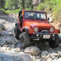
We went up Death Valley Road out of Big Pine (towards North Pass). Big road closed sign in the middle of the road with plenty of room to go around. (ha ha) then came another advisory sign listing "road to Scotty's Castle Closed", "Road to Pahrump Closed", + about 4 other locations. We turned off at Papoose Flat Road (11 miles in) and thats were we found the Inyo County workers + a volunteer. The volunteer said he just took the road all the way to Scotty's Castle last week (after the storm) and had no problem. We didn't talk about North Pass or Saline Valley Rd. Once he said no problem to Papoose Flat I abandoned the backup plan of heading to Whippoorwill Canyon.
Scare tactics? probably. It is a dangerous place for the unprepared to travel in. I think its the County's way of liability containment. And if it scares off the novices, all the better.
BTW, this was my second trip up to Papoose Flat. That area is quickly becoming one of my favorites. Definitely going back. We spent 5 days on trails between Bridgeport and Lone Pine. The only time we saw "any" vehicles (on the trails) was up at Laurel Lakes.
Temps in the Owens Valley floor: 103 in Bishop, 98 in Lone Pine
Temps in the high country: Low 80's in the day, mid 60's at night.


 Sportsmobile (AKA Money Pit)

 Linear Mode