|
|
 04-20-2019, 06:27 PM
|
#1
|
|
Senior Member
Join Date: Apr 2007
Location: Seattle, WA
Posts: 1,061
|
More Baja Fun!
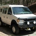
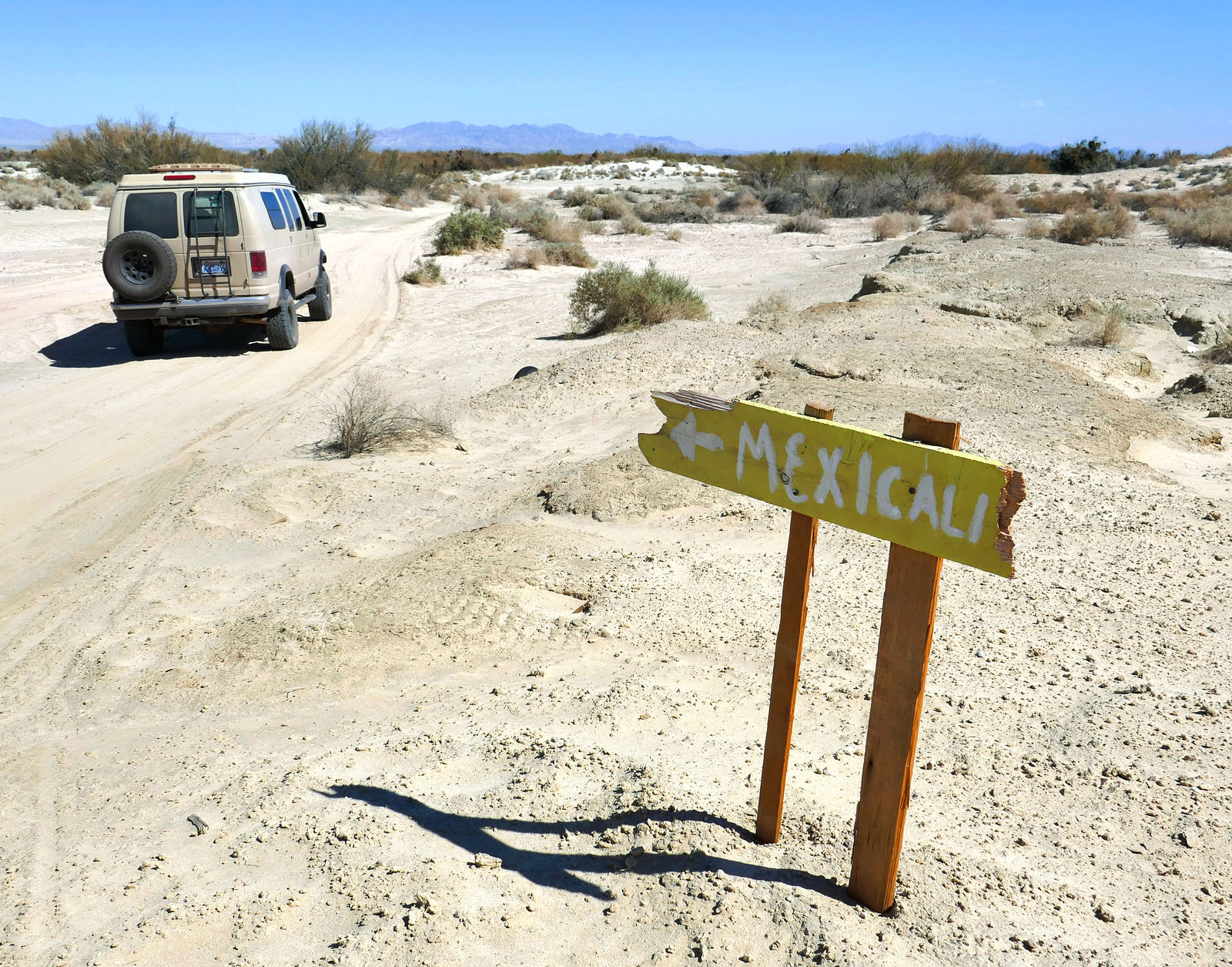
I entered Mexico via the Mexicali East border crossing, my van was briefly searched, complete with scent-sniffing dog. Any idea what they were looking for entering Mexico? Who smuggles drugs into Mexico?

__________________________________________________ _
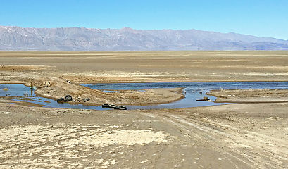
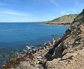
Laguna Salada
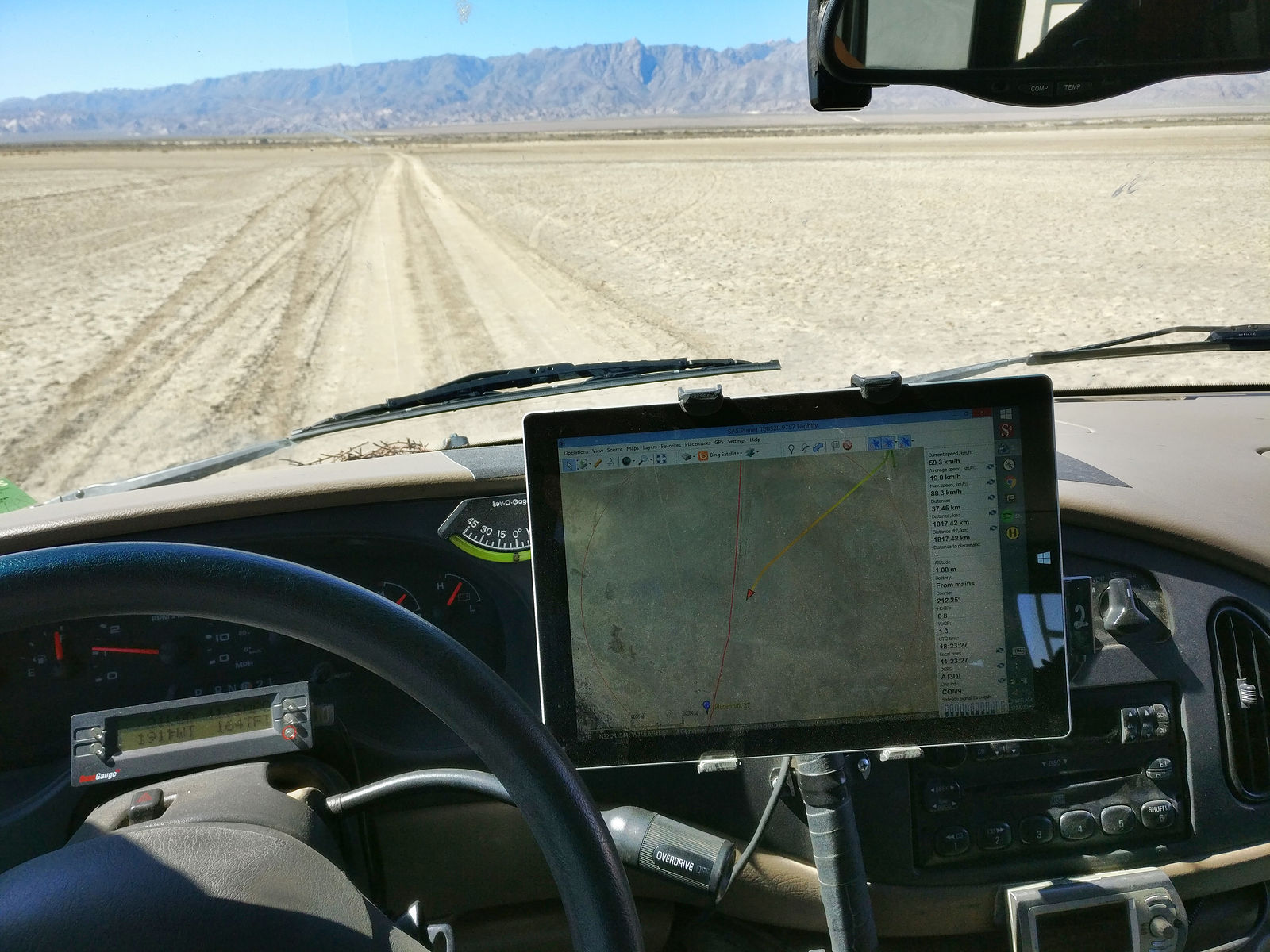
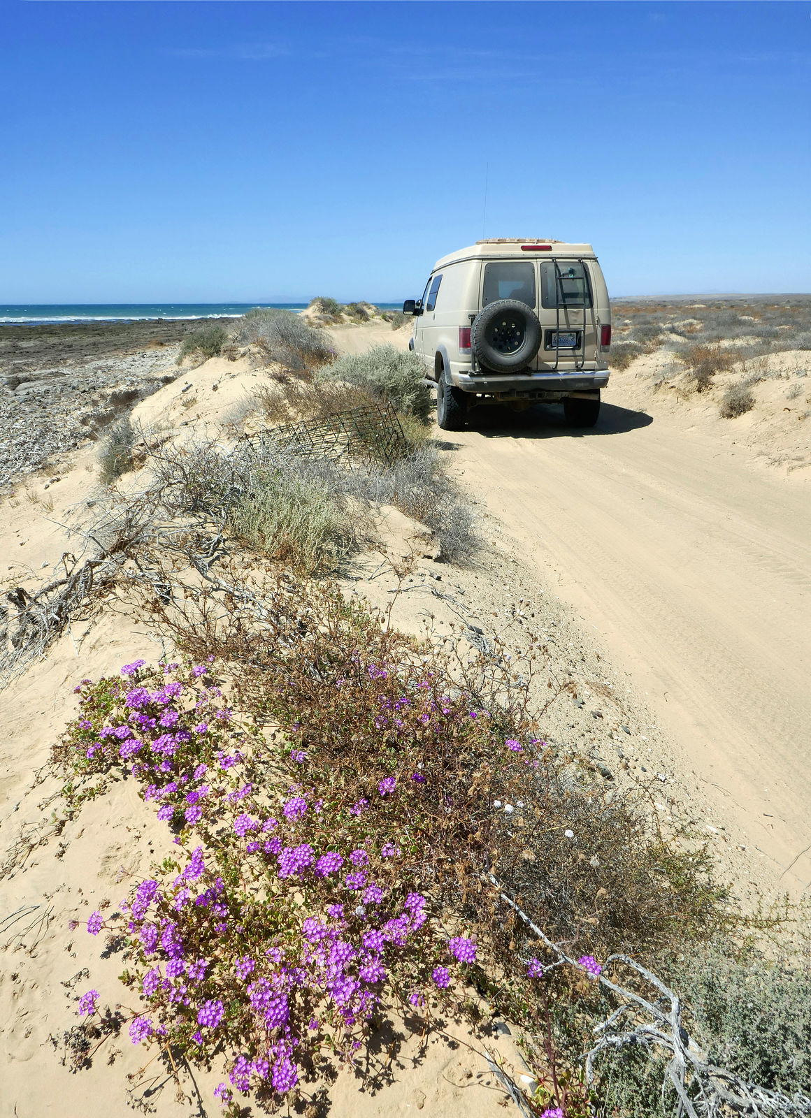
I started with Laguna Salada. Here I am at the Highway 2 entrance to the dry lakebed, enjoying the shade of one these fat red pillars while I air down my tires. I suppose they're so big in order to be seen from a distance when lost out on the playa, but I like to think of them as the entrance gate remains of some long-gone lakebed tourist resort. (GPS:32.5698,-115.7899)

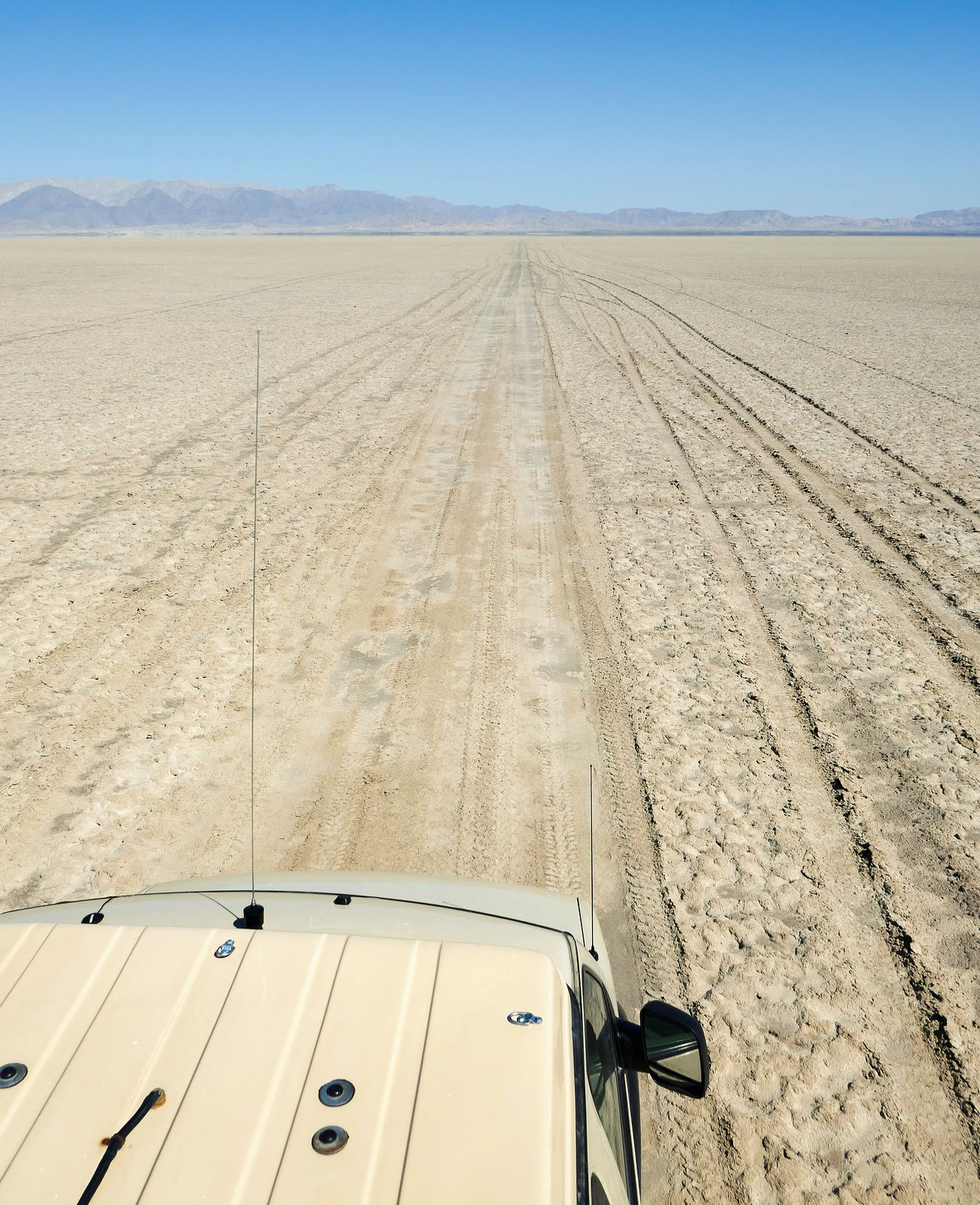
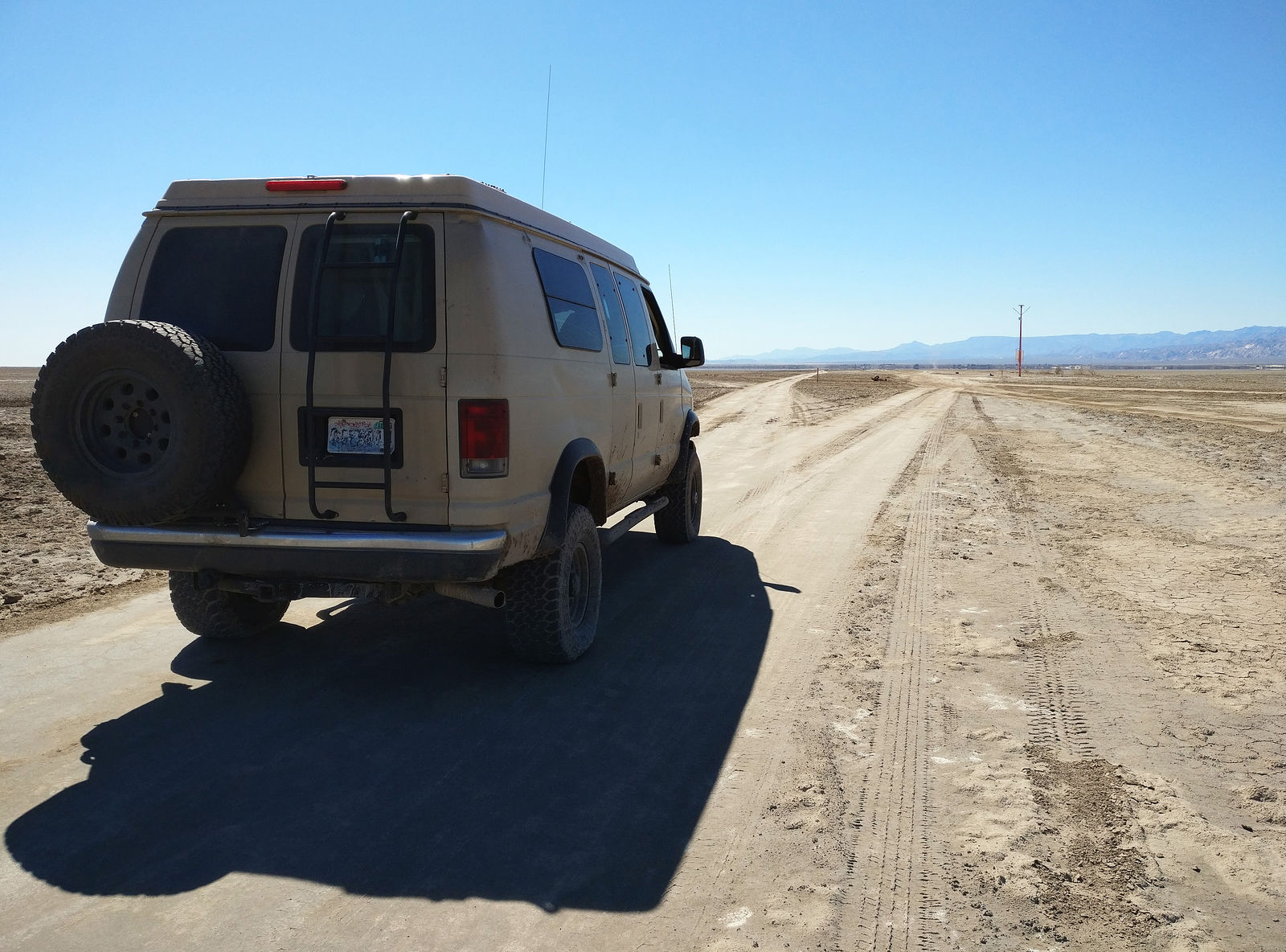
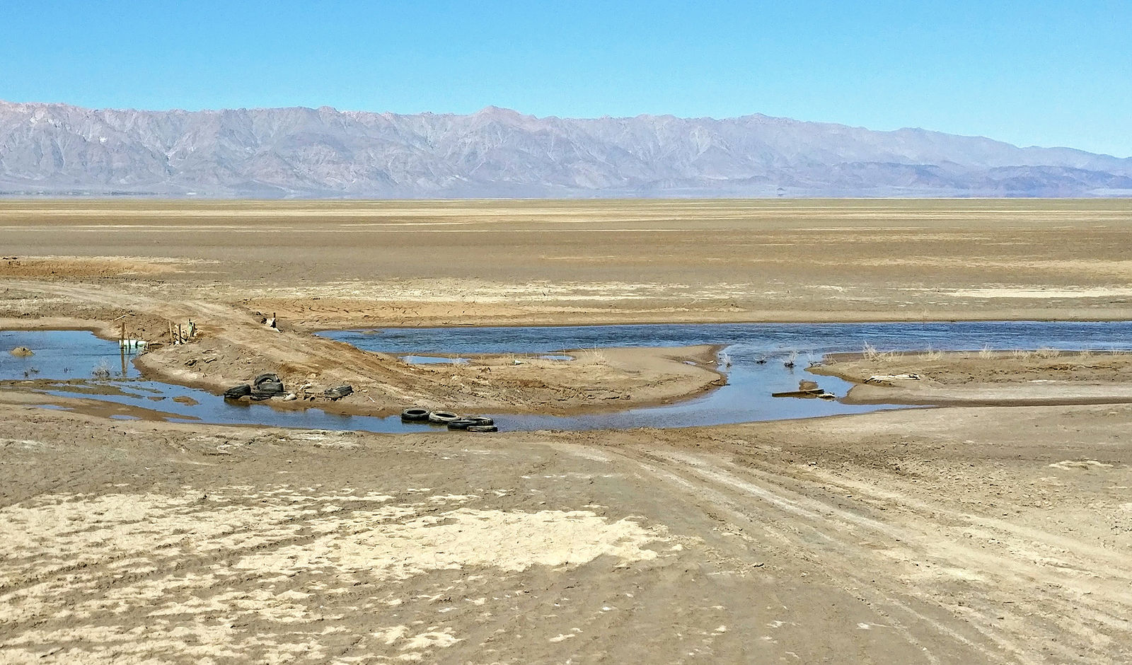
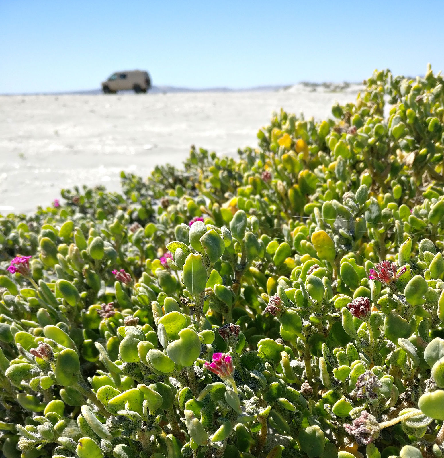
Driving on the lakebed. I was afraid recent rains would make it impassably muddy, but it wasn't bad. Still, I learned it was best to stay on existing tire tracks where the dirt has been compacted.
   
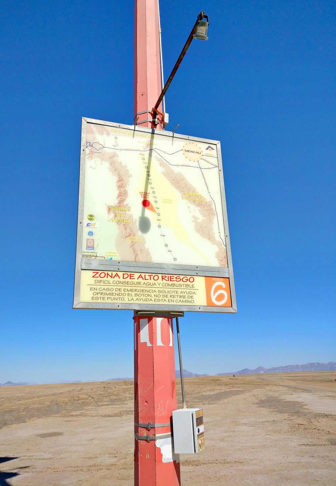
I ran across this red mast way out in there flatness. It turned out to be some kind of safety beacon with a map, emergency call box, and a cache of water! Wow, very thoughtful! (GPS:32.2653,-115.6660)
   
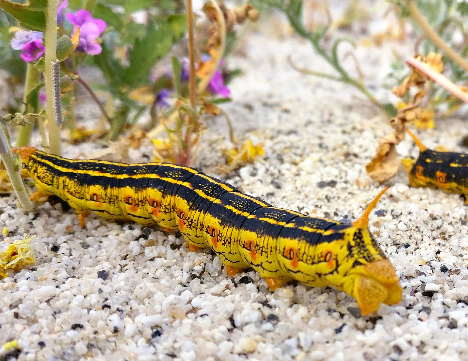
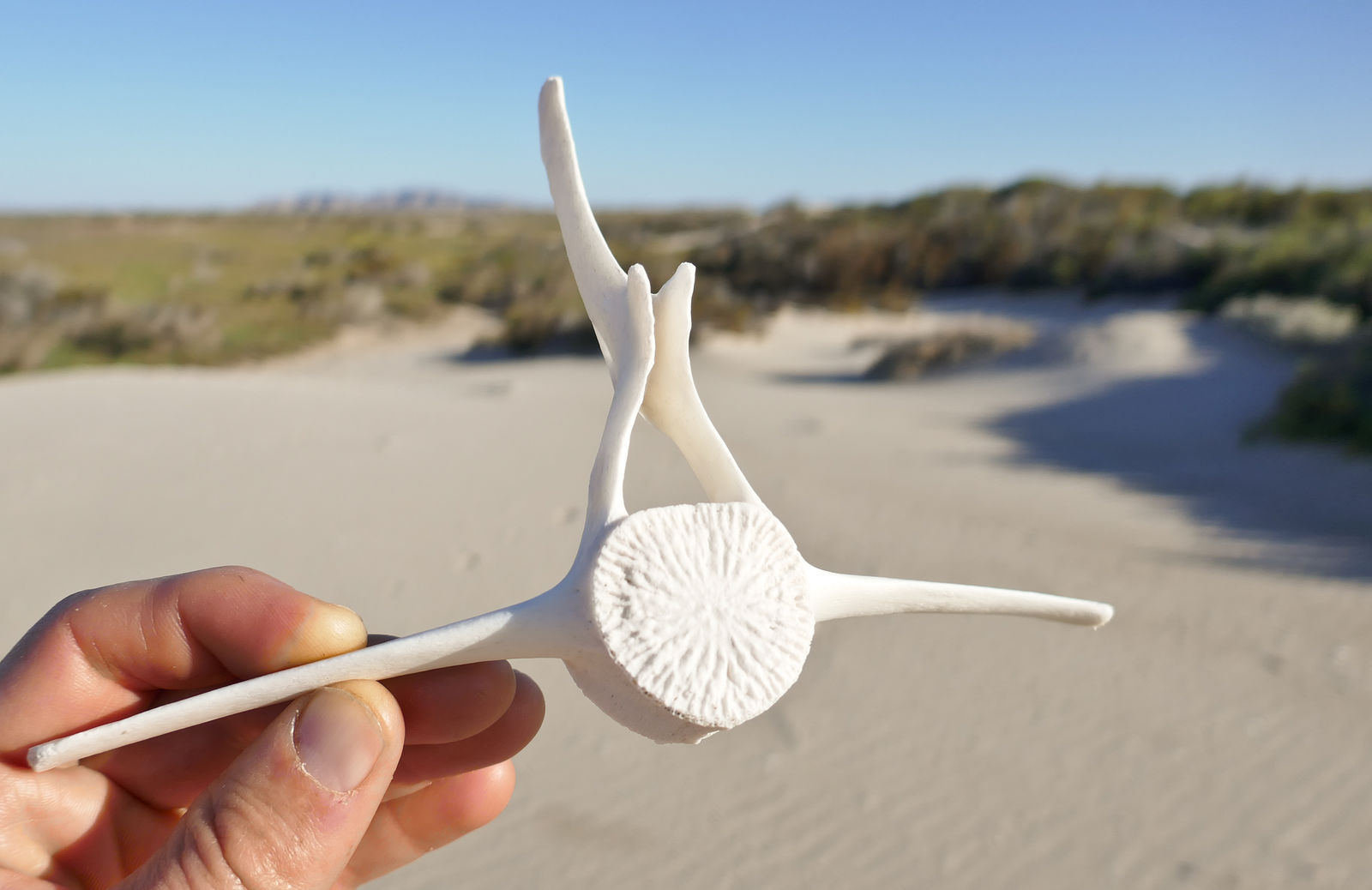
At some point I climbed a little dune on the west side of Laguna Salada and stopped there for lunch. I was sitting in the sand, munching my sandwich while enjoying the view and appreciating all the little magenta flowers surrounding me, when I noticed the plants were all wriggling!
I took a closer look. No, not the plants themselves, but caterpillars! There must have thousands! Several clung to each plant, and they were all munching away. There were at least 20 just within my arms' reach. Some big and fat, some tiny. At least one had been squished under my butt.

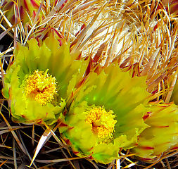
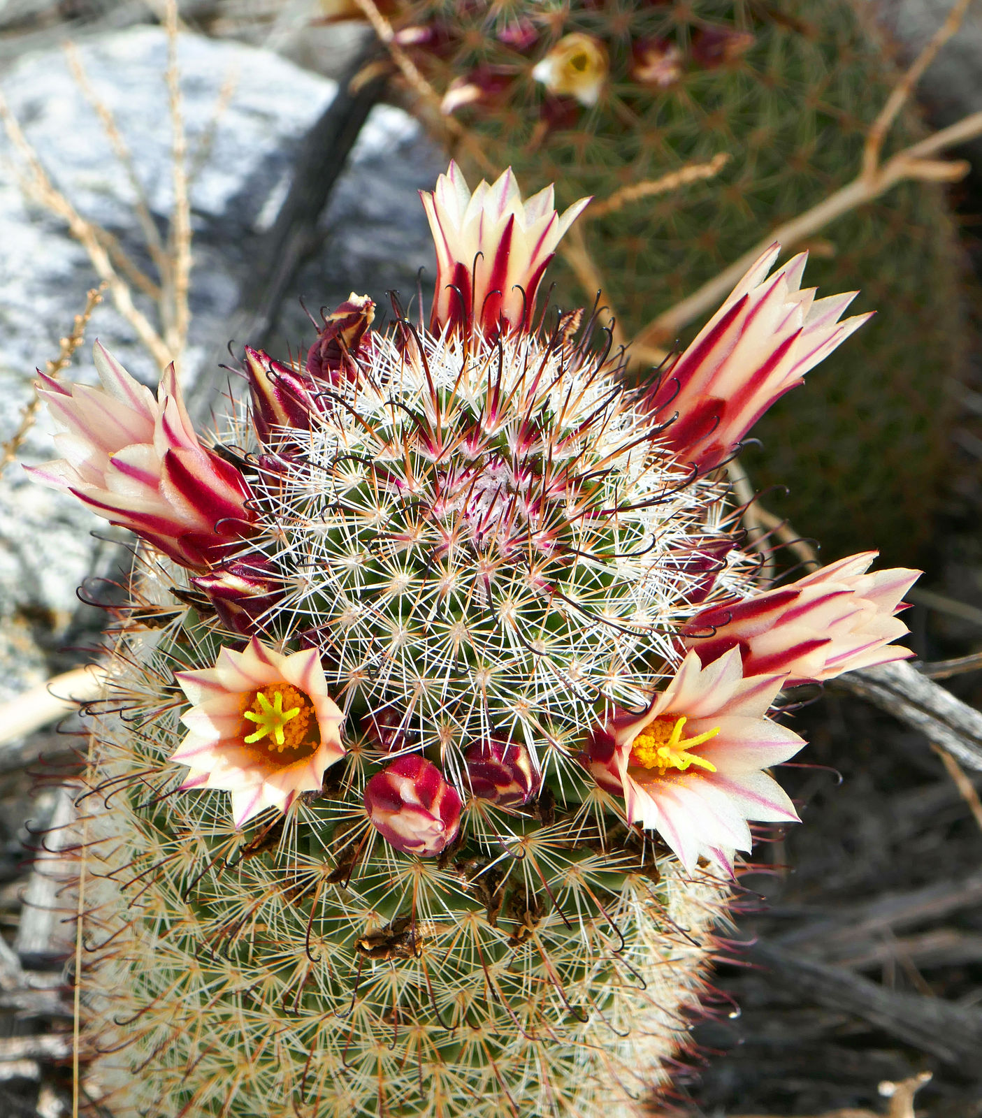
Cactus blooms.
( end of part 1...)
|

|

|
|
04-20-2019, 06:28 PM
|
#2
|
|
Senior Member
Join Date: Apr 2007
Location: Seattle, WA
Posts: 1,061
|
Part 2
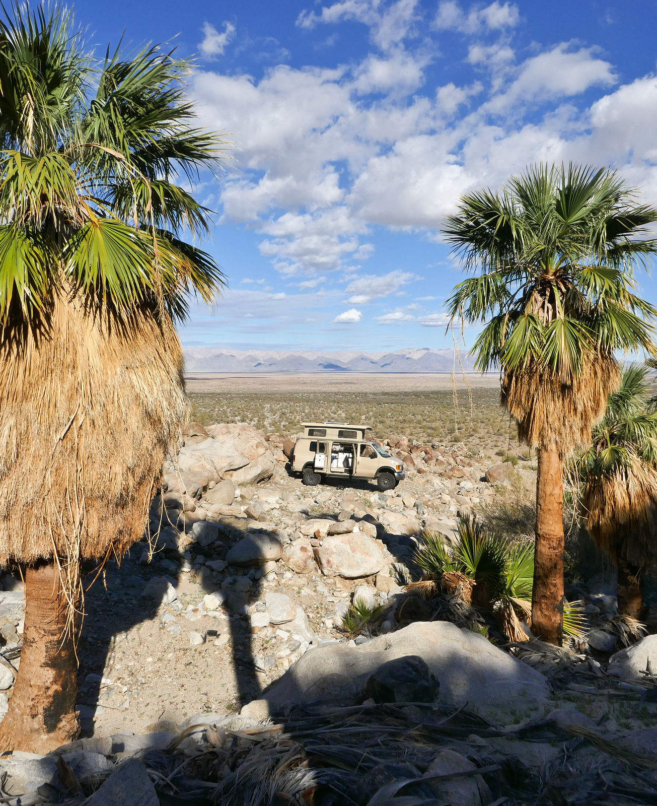
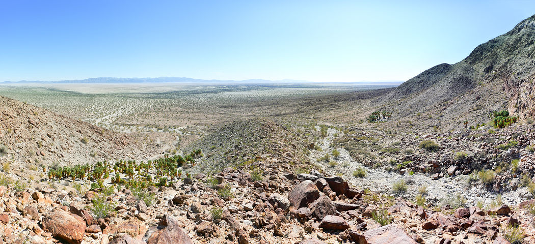
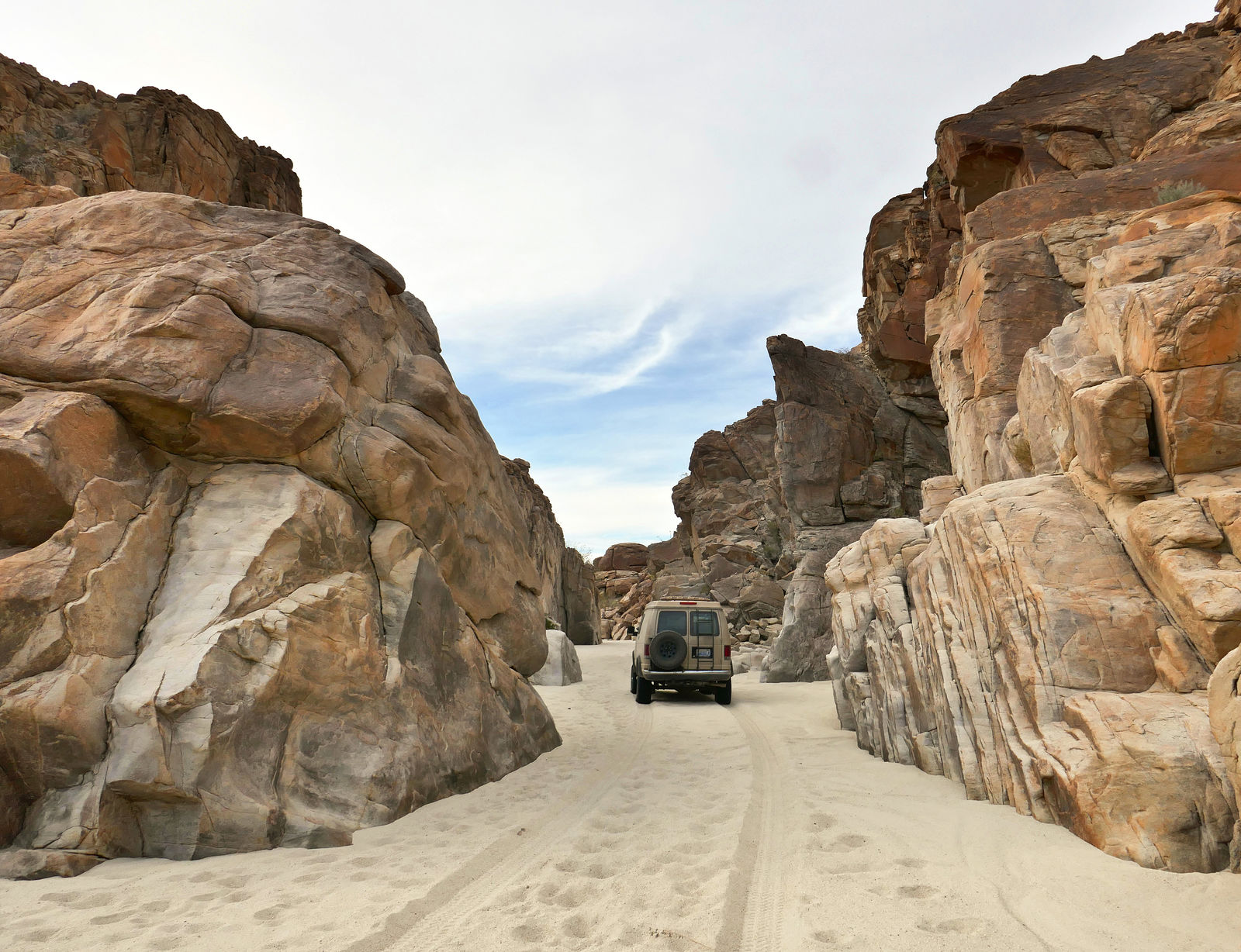
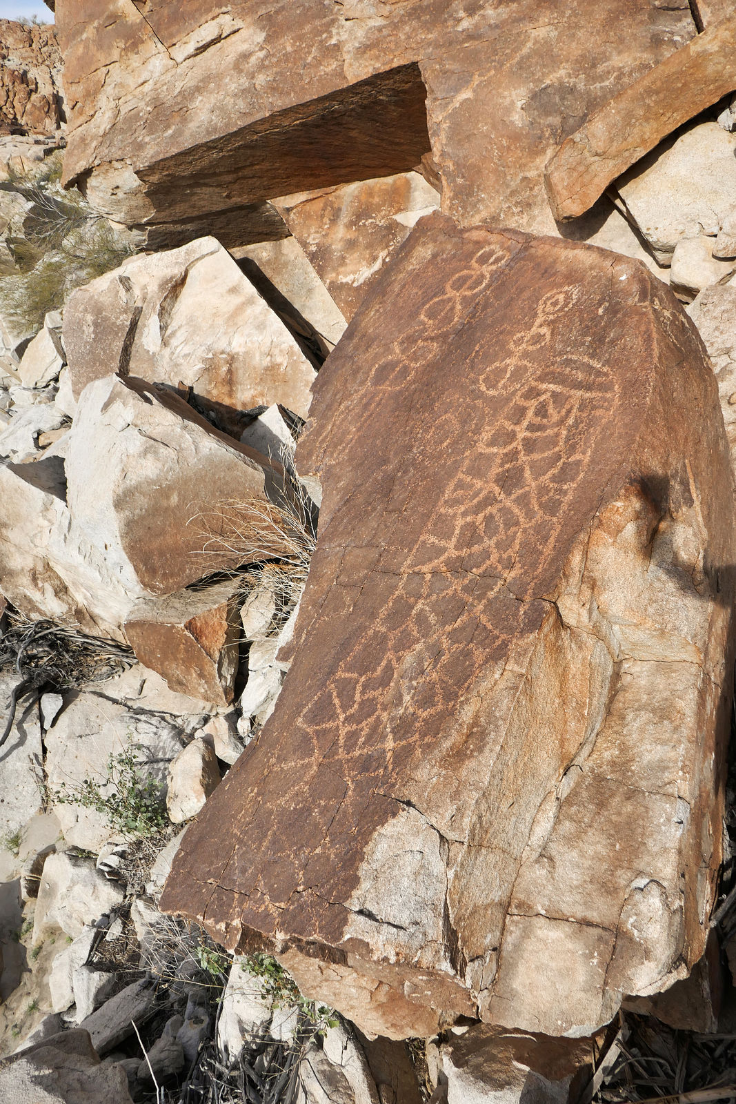
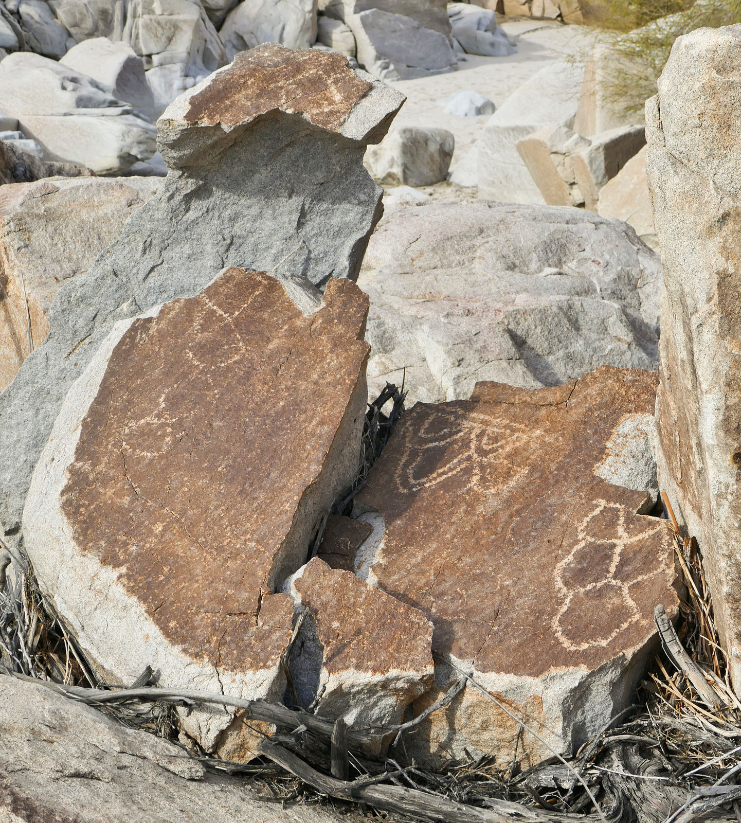
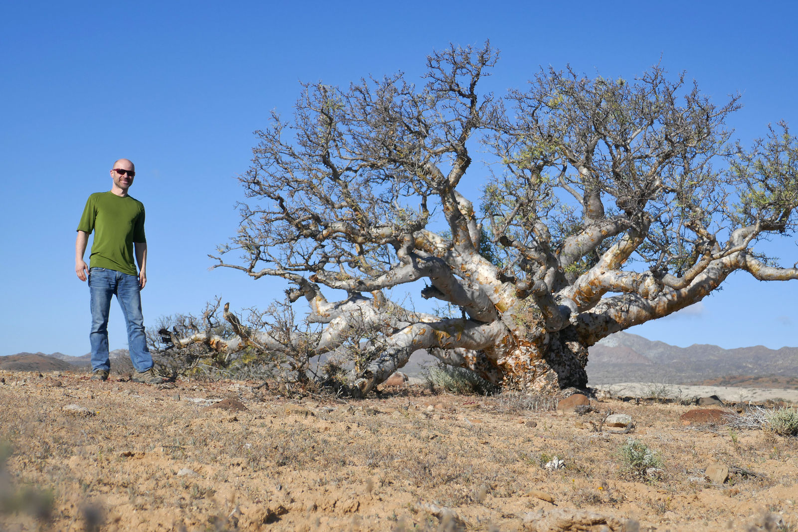
Cantu Palms
West side of Laguna Salada (GPS:32.3517,-115.8275)
 
I had already explored this canyon in the past, but at the time I had somehow missed that there were petroglyphs in the area. (I only read about them later when I got back home.) This time I did find the petroglyphs, which are scratched into the rocks on the ridge separating the north grove of palms from the two groves to the south.
 
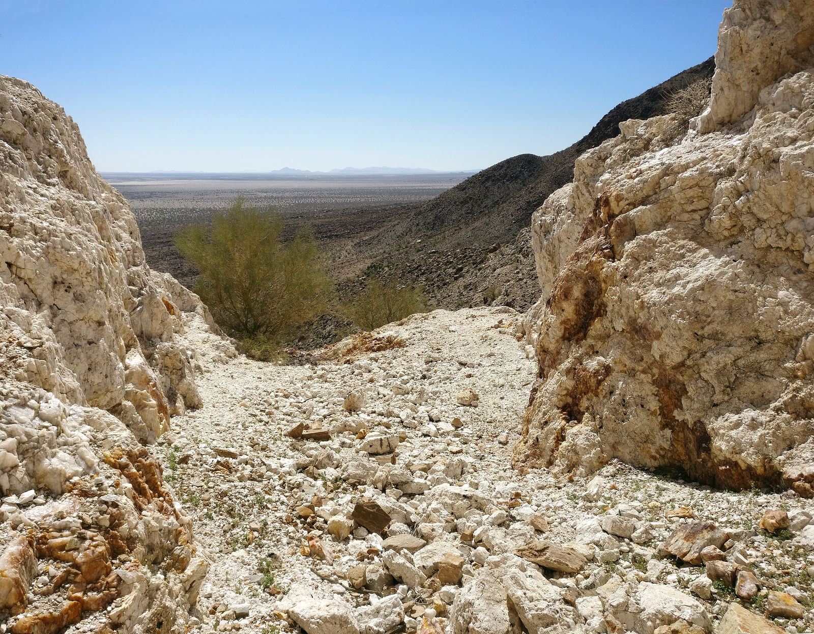
I checked out La Rosa Mine, a short hike up the canyon from these palms:
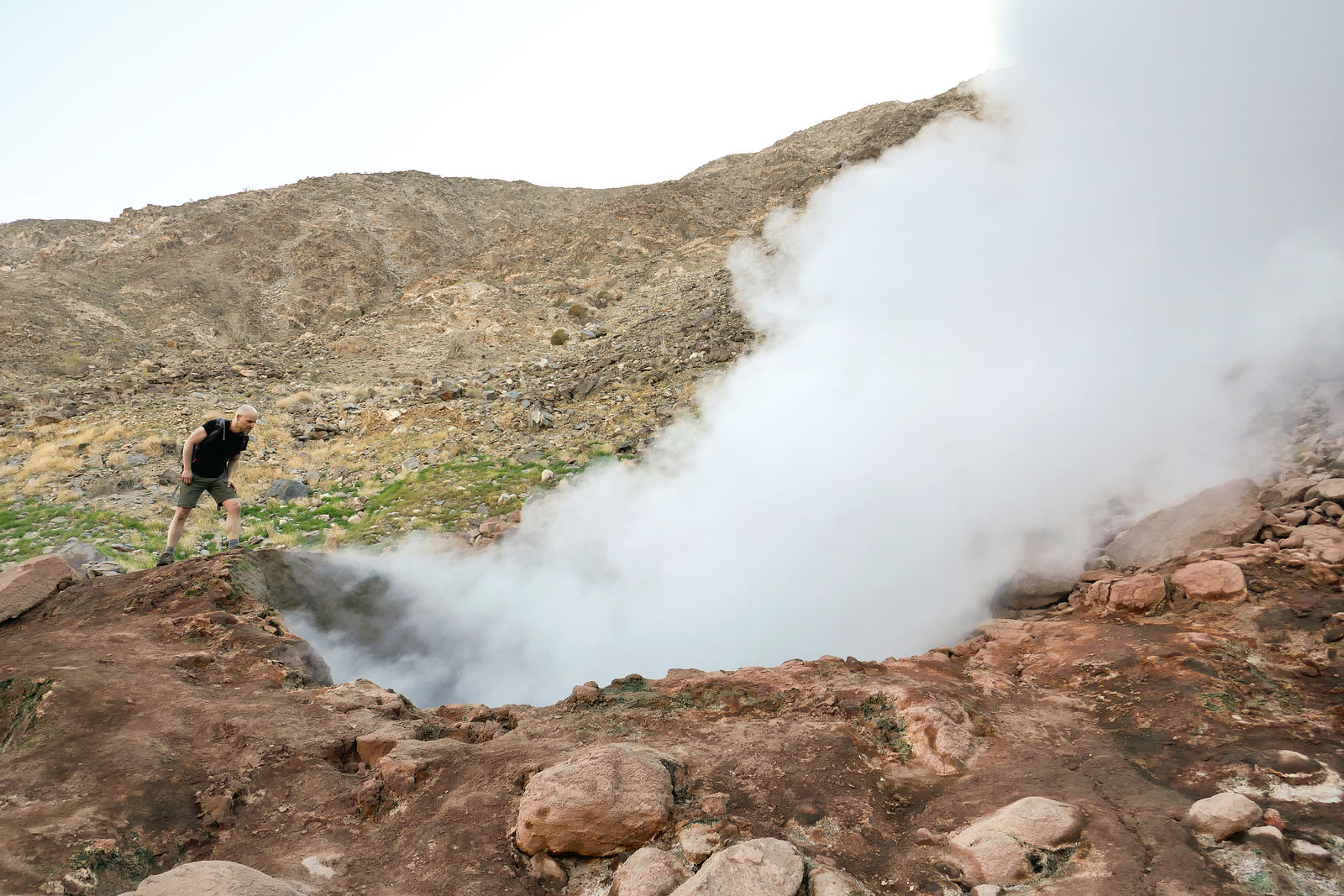
    Cucapá Fumarole
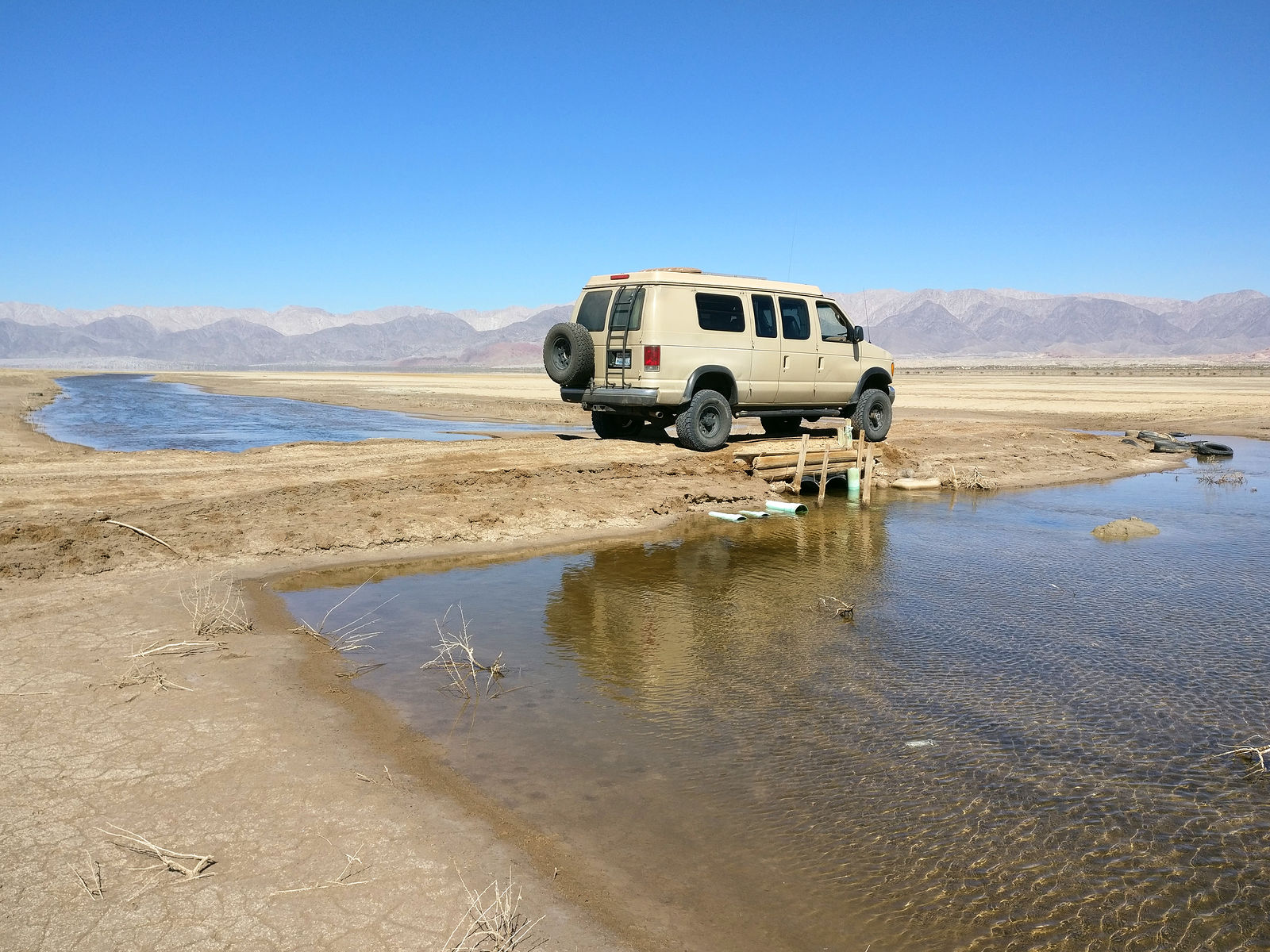
I cut east across Laguna Salada to Sierra de los Cucapá, where there was supposed to be a thermal steam vent (fumarole). Even when the lakebed is dry, there is still a bit of water to cross. Here is the muddy-bottom canal, which can only be easily crossed in a few places. (GPS:32.2968,-115.5835)
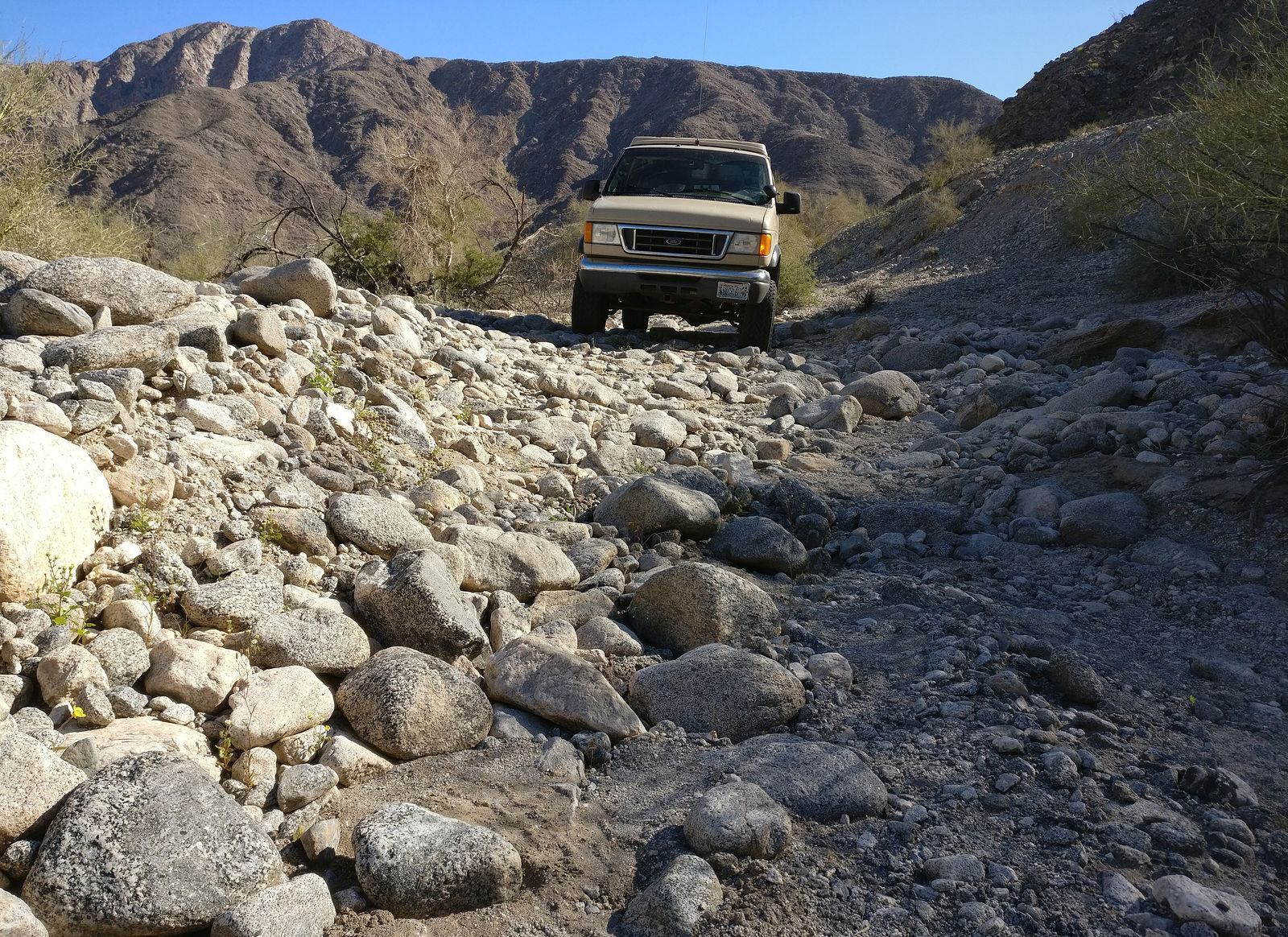
Entering David Canyon, and driving up the wash
  
At (GPS:32.3189,-115.4133) I parked the van and hiked the last half mile to the fumarole site. A quarter mile later, I started to hear something like a distant jet engine, and spotted a plume of steam rising into the air.
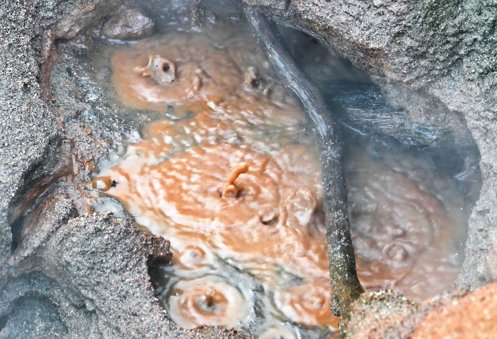
The fumarole is loud. I carefully leaned over to peer down into the sulfur-smelling rising steam and boiling muddy water below. The surrounding ground is too hot to allow normal plants to grow, but there is a strange green substance (algae?) living among the rocks. Here's a little video: https://youtu.be/fl8rgEin-bY (GPS:32.3269,-115.4170)
  

( end of part 2...)
|
|
|
|
|
04-20-2019, 06:31 PM
|
#3
|
|
Senior Member
Join Date: Apr 2007
Location: Seattle, WA
Posts: 1,061
|
Part 3
|
|
|
|
|
04-20-2019, 06:33 PM
|
#4
|
|
Senior Member
Join Date: Apr 2007
Location: Seattle, WA
Posts: 1,061
|
Part 4
Heading South
Percebú / Shell Island
I always enjoy camping here. (GPS:30.7878,-114.7003)
    Highway 5
Heading south from San Felipe, I found the road to Puertecitos (repaved some years ago) to again be in poor shape. The area was very busy road crews working on repairs.
On the other hand, the plug seemed to have been pulled on Highway 5 construction south of Puertecitos! I saw no sign of any activity since I passed this way in the last couple years.
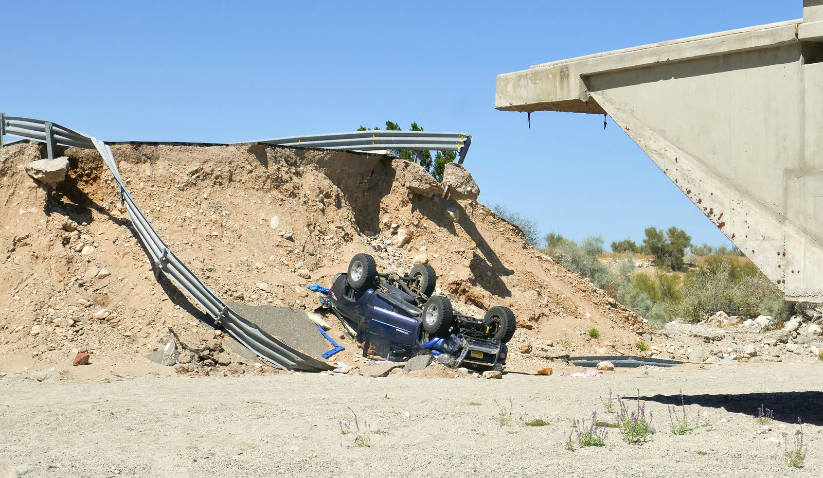
There is lots of storm erosion damage. I counted 10 bridges completely impassable, requiring all vehicles to take a bumpy bypass on dirt tracks.
 
The missing sections of road are marked with rocks and some orange cones or barrels, but that's not always enough. I passed a very sad scene where someone had not realized in time that the bridge was out.
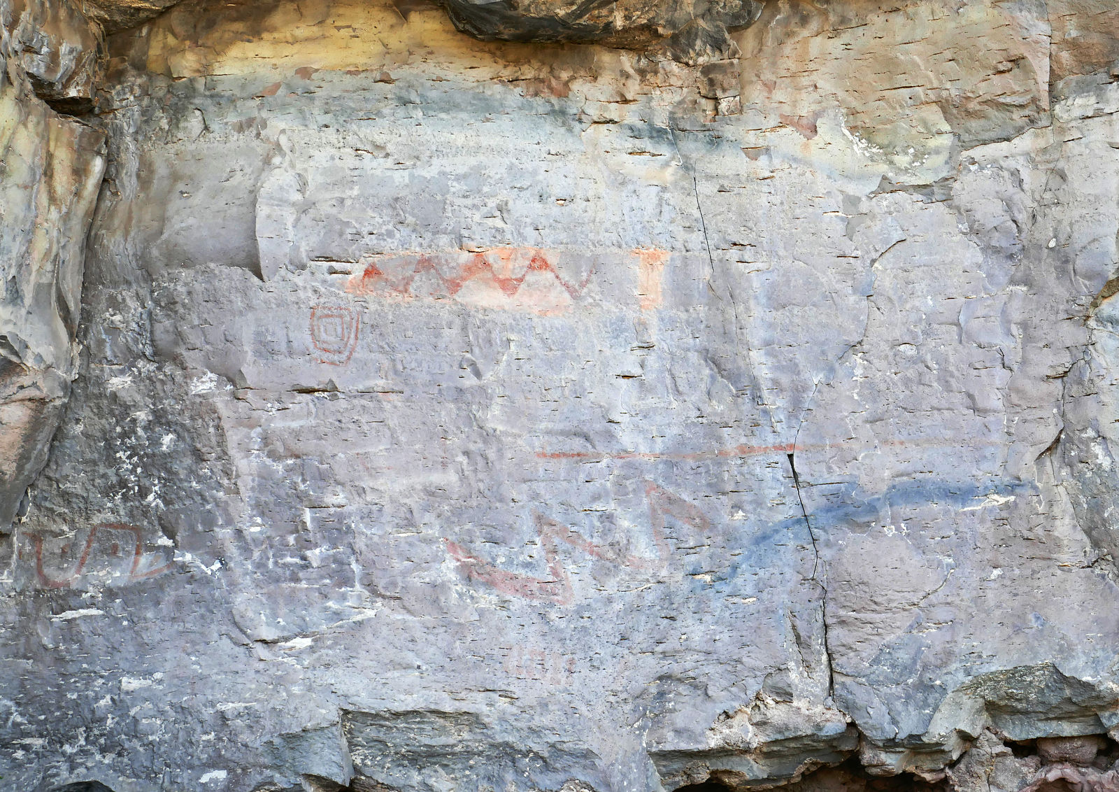
  La Angostura Pictographs
After meeting up with Highway 1, I headed south. I made a quick side trip to check out a rock art site about three miles up the road to San Borja from Rosarito. There are a few faint pictographs on the northeast-facing rocks.
  
( end of part 4...)
|
|
|
|
|
04-20-2019, 06:38 PM
|
#5
|
|
Senior Member
Join Date: Apr 2007
Location: Seattle, WA
Posts: 1,061
|
Part 5
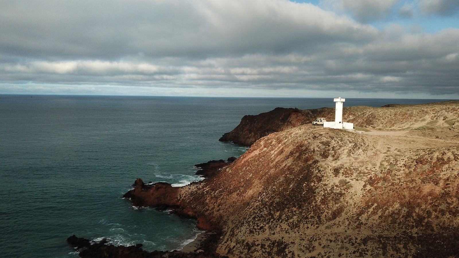
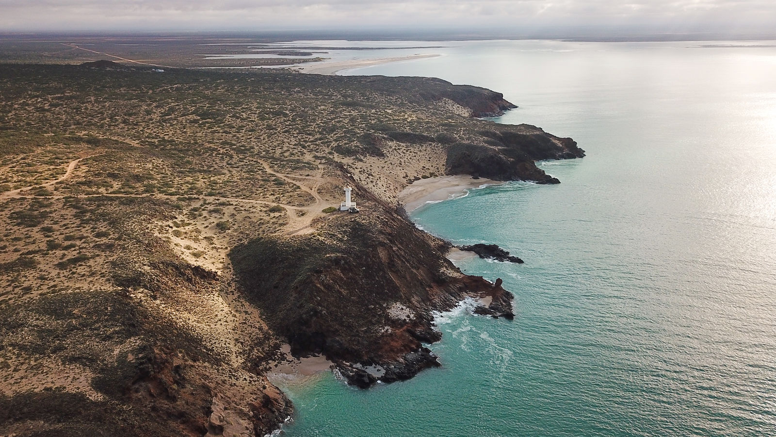
Punta Morro Santo Domingo
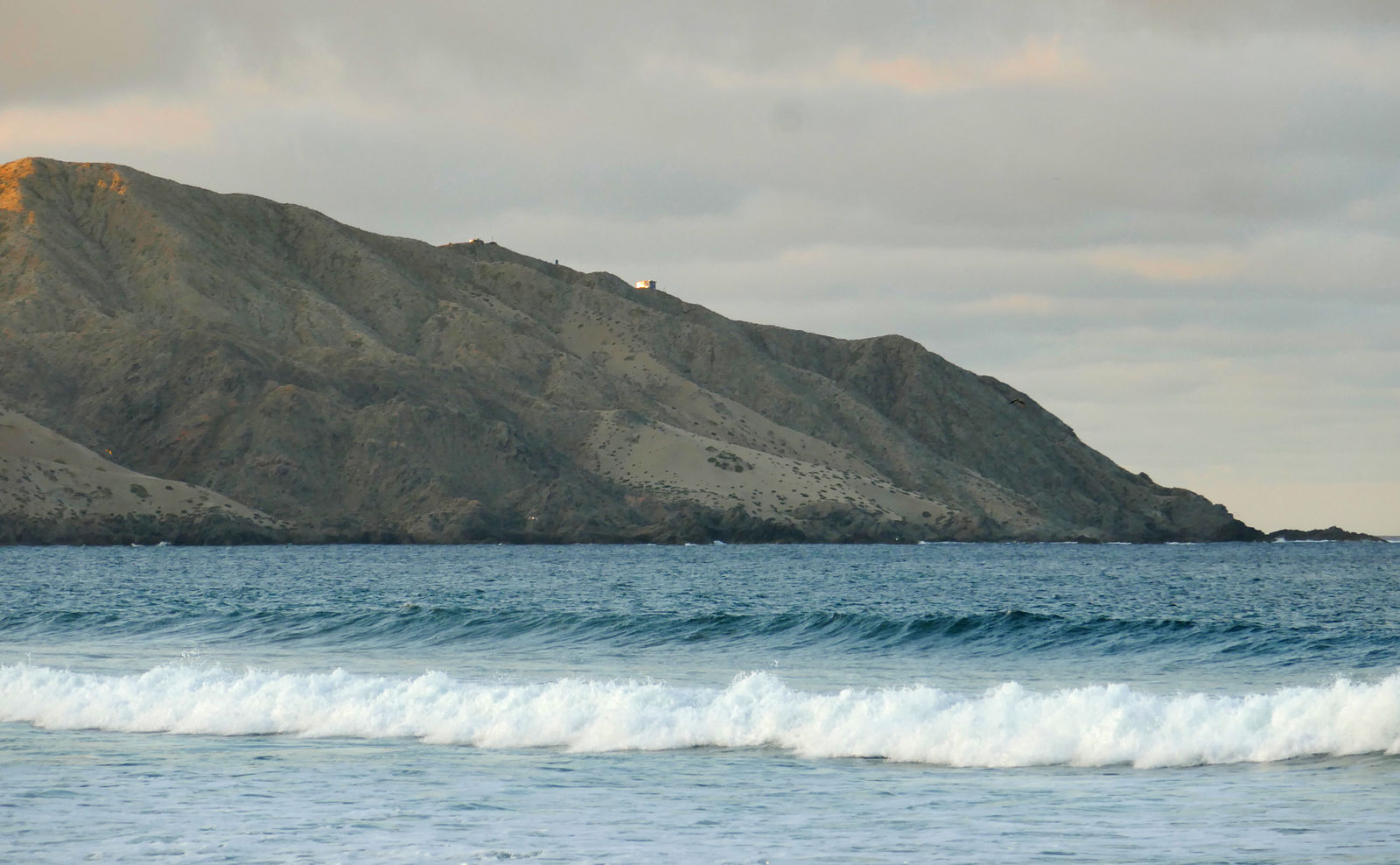
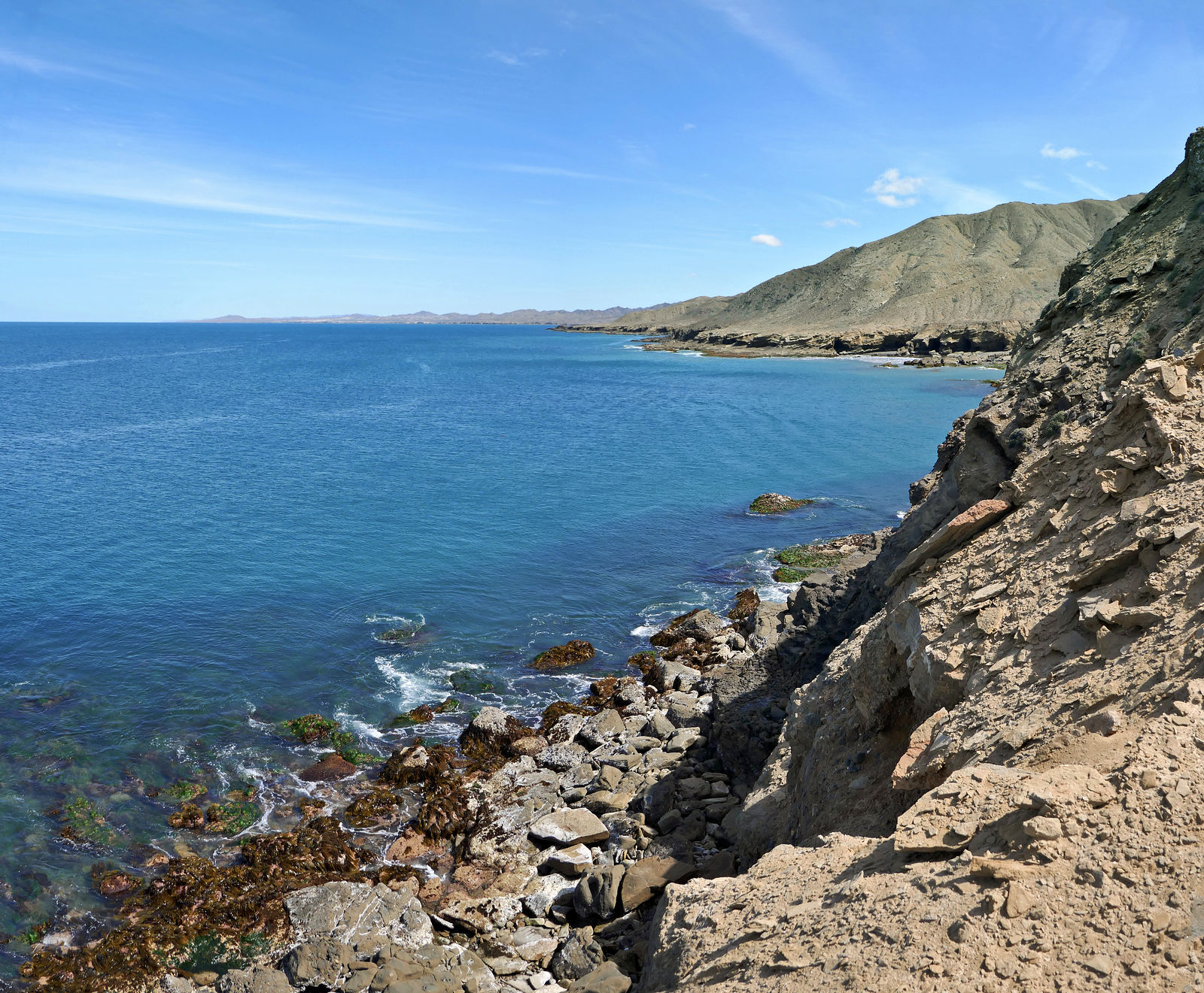
This is a favorite camping spot for me when passing through the Guerrero Negro area. I like to perch next to the Punta Morro Santo Domingo lighthouse at the top of the bluffs overlooking the rocky shore and crashing waves. (GPS:28.2383,-114.1054)
 
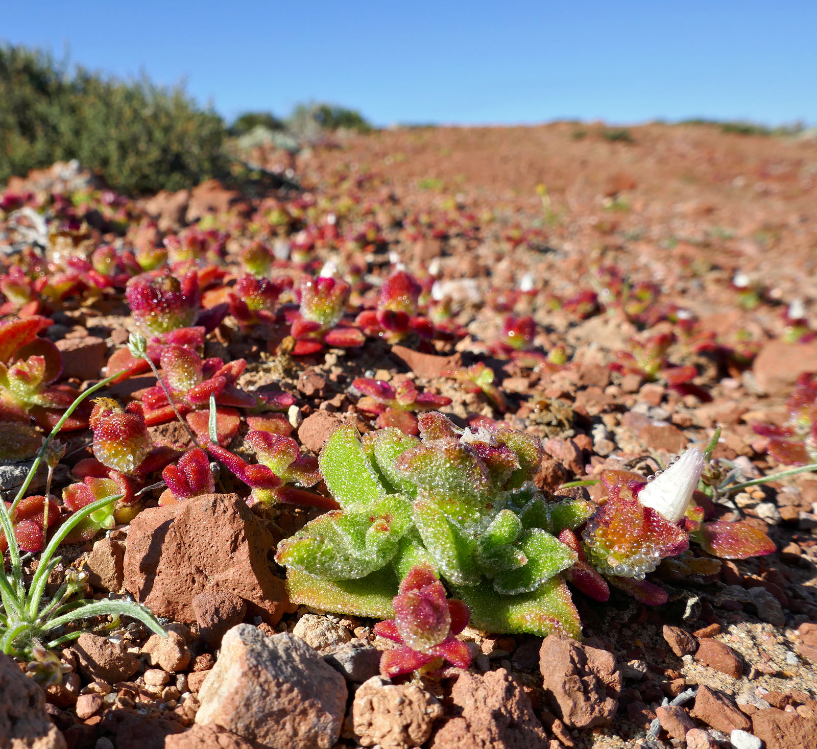
Little plants and lichens survive on the moisture from the sea spray.
  
You can drive up Cerro La Bulonera for a fantastic panoramic view of the area. (GPS:28.2383,-114.1054)
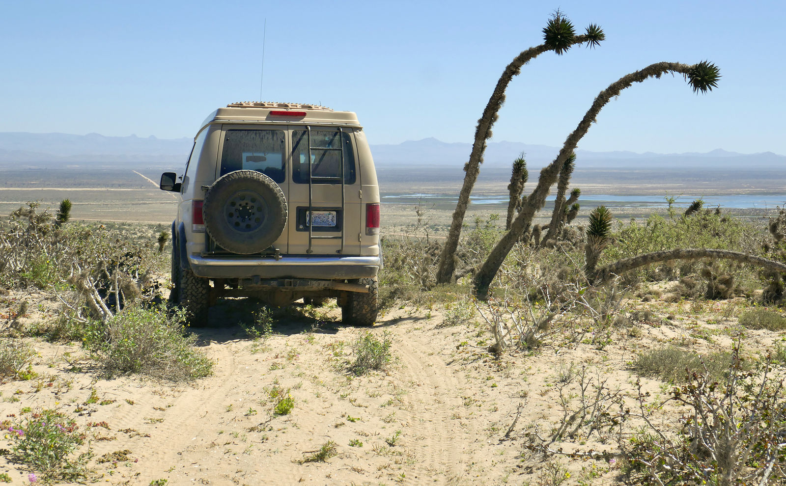
Datilillos (Tree Yucca)

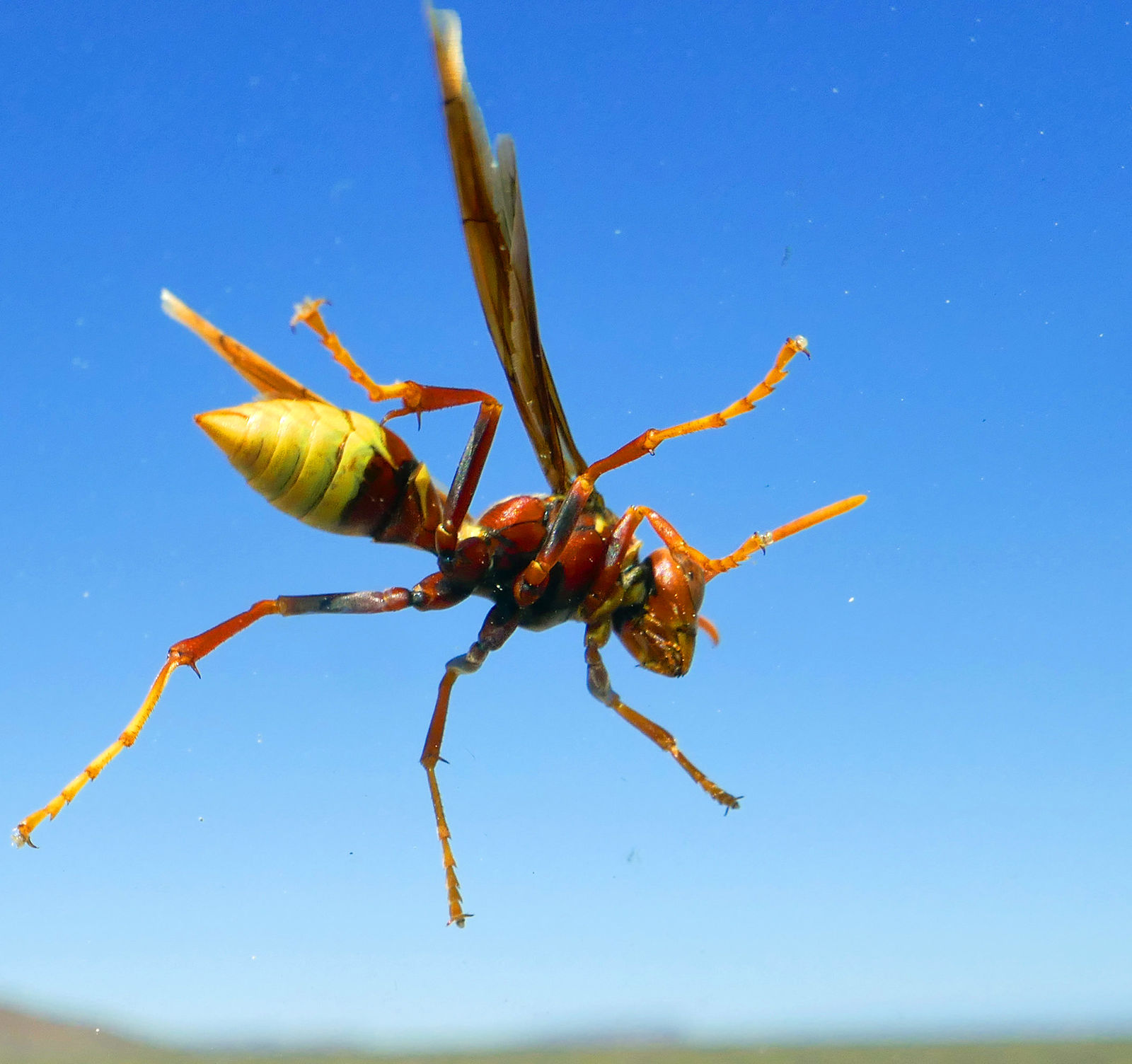
This beautiful creature paused to rest on my windshield. I didn't investigate whether she was friendly.

( end of part 5...)
|
|
|
|
|
04-20-2019, 06:41 PM
|
#6
|
|
Senior Member
Join Date: Apr 2007
Location: Seattle, WA
Posts: 1,061
|
Part 6
Vizcaino Loop
Next I made a big clockwise loop of the Vizcaino peninsula. I started at Punta Abreojos, and intended to finish by trying to get over to Malarrimo Beach from the west.
Campo Rene
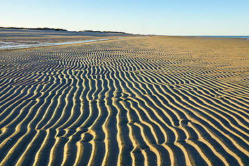
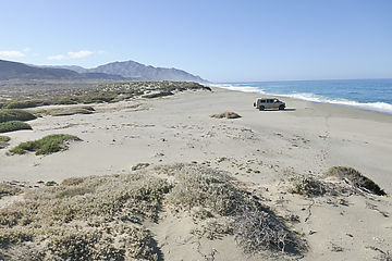
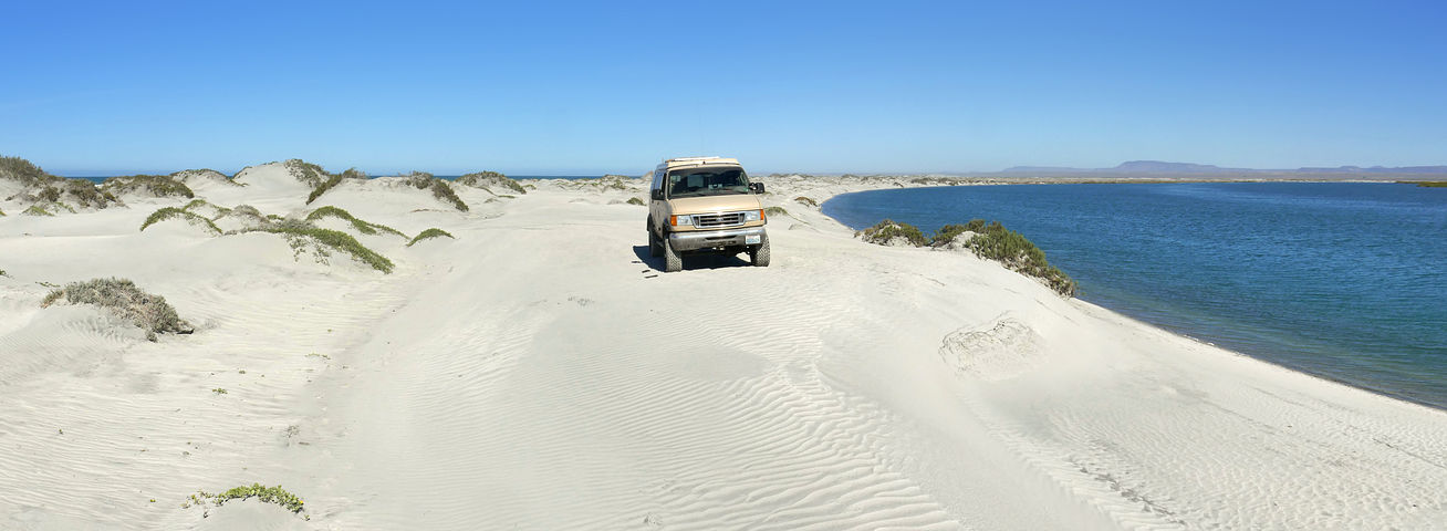
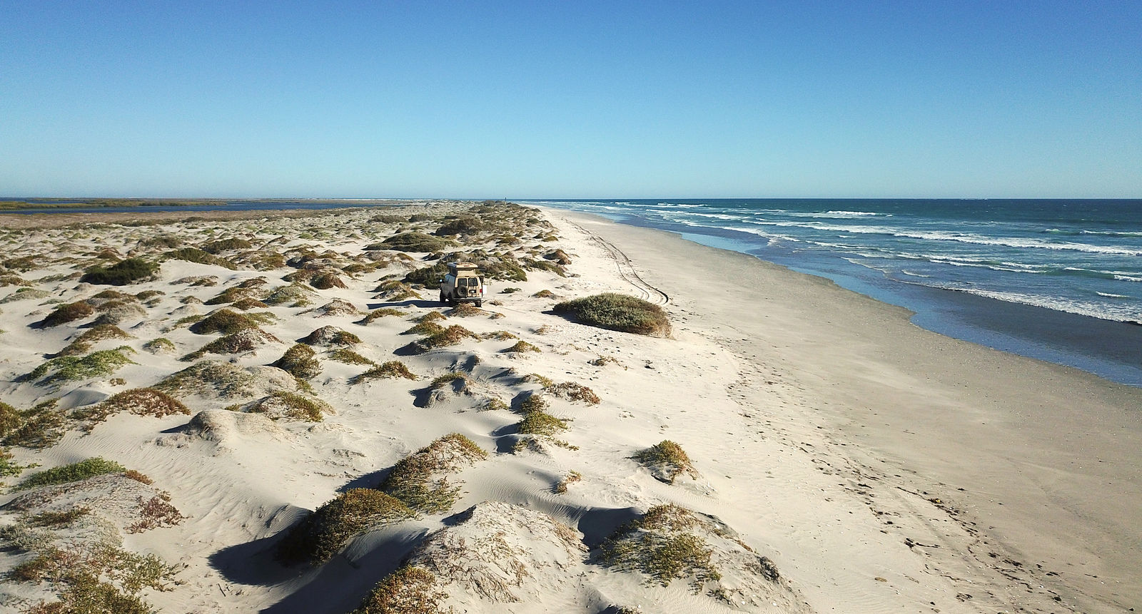
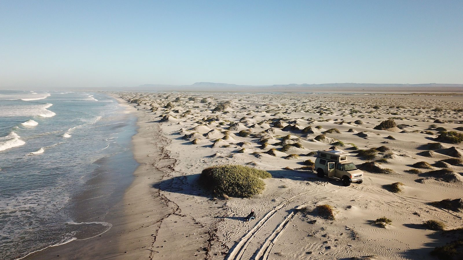
Six miles before arriving at the town of Punta Abreojos is a sand bar with extensive long flat white empty sandy beaches. (GPS:26.7914,-113.5059)
 Punta Abreojos
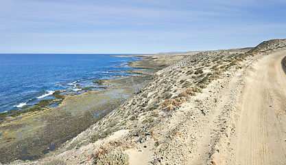
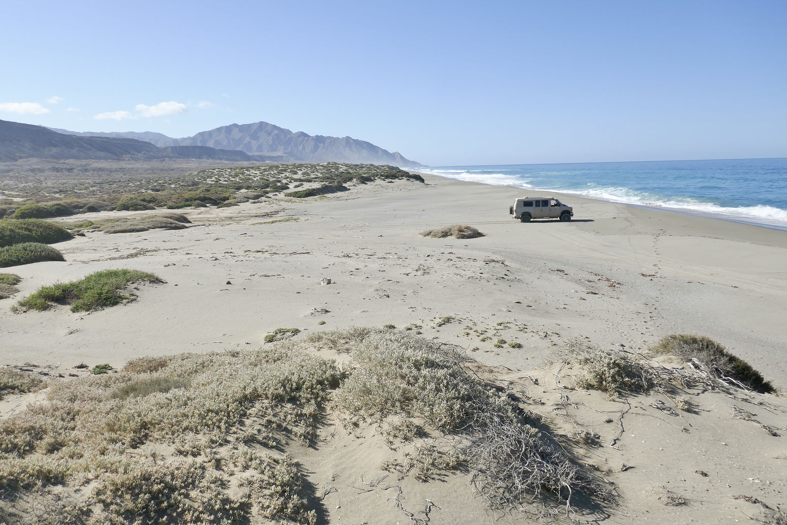
There is a 10-mile long sand bar extending northwest from Punta Abreojos. For the first 5 miles, there is a road - which ends at a fishing spot on Estero la Bocana (GPS:26.7384,-113.6436). I passed the first of many "vigilancia" shacks I would come to see dotting the coastline all along Vizcaino. These are manned by guards enforcing fish anti-poaching laws.
 
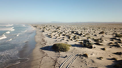
For privacy, I drove along the beach a mile past the end of the road, and camped between some dunes. (GPS:26.7474,-113.6505)
    Estero la Bocana
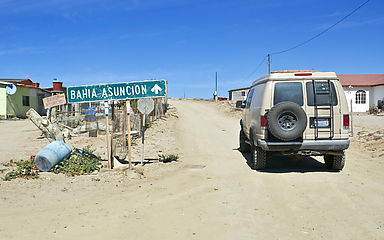
Passing through the village of Estero la Bocana on the way to Bahía Asuncion
( end of part 6...)
|
|
|
|
|
04-20-2019, 06:45 PM
|
#7
|
|
Senior Member
Join Date: Apr 2007
Location: Seattle, WA
Posts: 1,061
|
Part 7
Bahía San Hipolito
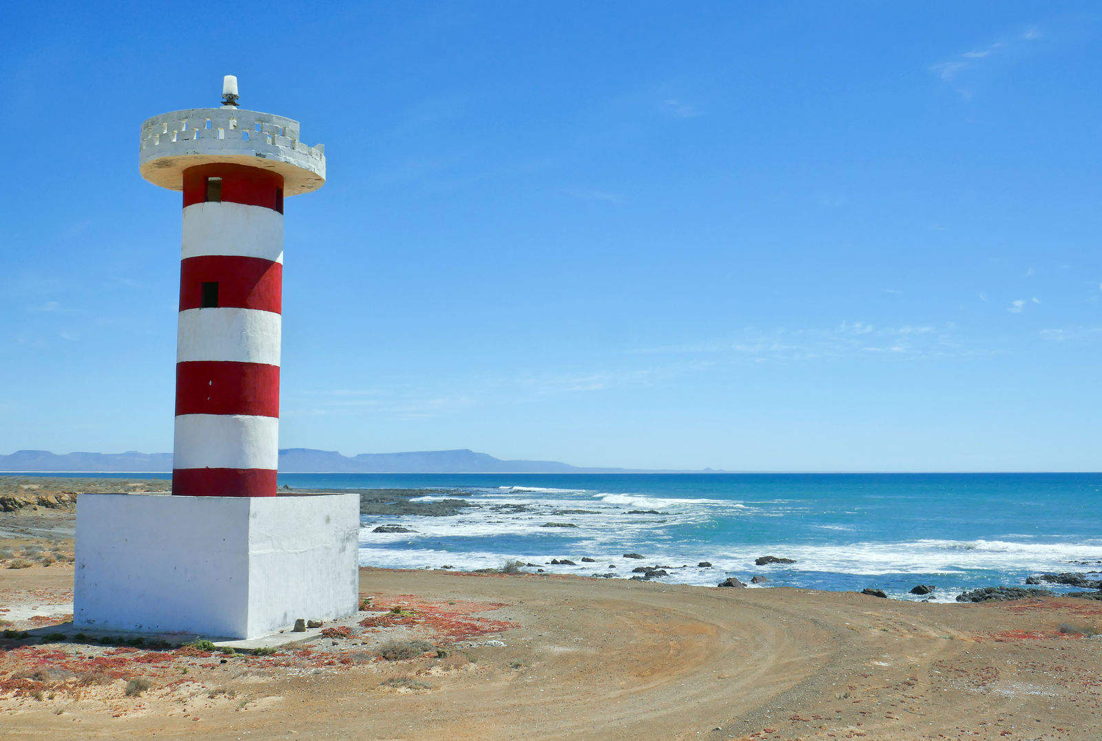
Bahía San Hipolito has a big beach of white sand and broken shells. There is beach access at El Batequito (GPS:26.8683,-113.7591)
 
The lighthouse at Punta San Hipolito. I stopped to climb the lighthouse, and then poke around the rocks and tidepools. (GPS:26.9729,-113.9886)
  
Scenic beach continues around the corner of Punta los Lobos.
 Bahía la Asuncion
Continuing northwest, I passed Punta Prieta on to the beaches of Bahía La Asuncion. Here's another vigilancia shack. (GPS:27.0359,-114.0533)
   Playon San Pablo
Around the corner from Punta San Roque is the beach Playon San Pablo. You can get there by heading north over the steep windy vigilancia tracks on the rocks of Punta San Roque, but this time I took an easier inland route. I turned southeast at (GPS:27.2115,-114.4064) and followed arroyo San Andrés down to the shore. (GPS:27.2061,-114.4311)
 
As the sun set, I played a little game of at making at least a small effort to minimize my use of lights, as to not attract the attention of the vigilancia - whose shack I could see perched up on the rocks at the south end of the beach. But, sure enough, just as I was dozing off to sleep, a pickup truck roared up and some vigilancia guys jumped out to check in on me. As always, they were perfectly friendly, but late night visits from strangers aren't a feature I look for in my vacations.

The next day I headed back along arroyo San Andrés and went then north-northwest a few miles inland to Bahía San Cristóbal. I started seeing a bunch of elephant trees (a "forest" perhaps?) in the vicinity of a hill the map calls Cierra el Elefante.

( end of part 7...)
|
|
|
|
|
04-20-2019, 06:48 PM
|
#8
|
|
Senior Member
Join Date: Mar 2015
Location: Maryland
Posts: 3,388
|
Think its fantastic that you shared your trip - Well Done & great photos! Looks like you had a fun time...somehow I missed the Pic of your cooler overflowing with iced cervezas ???
__________________
TwoXentrix
"AWOL"
|

|
|
|
04-20-2019, 06:49 PM
|
#9
|
|
Senior Member
Join Date: Apr 2007
Location: Seattle, WA
Posts: 1,061
|
Part 8
Bahía San Cristóbal
I followed arroyo El Tordillo down to check out this beach on Bahía San Cristóbal. (GPS:27.3246,-114.4861)
  El Playon
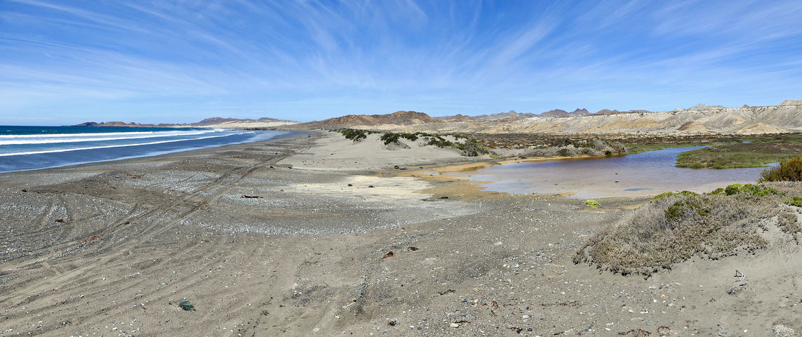
I made it back to the main Vizcaino highway at San José de Castro, and continued northwest past Bahía Tortugas towards Punta Eugenia, checking out some beaches on the way. Here is El Playon, a decent beach, but the lagoon seems to collect trash blown about. Blowing trash is sadly a common issue in the Vizcaino. (GPS:27.7100,-114.9441)
  Punta Quebrada
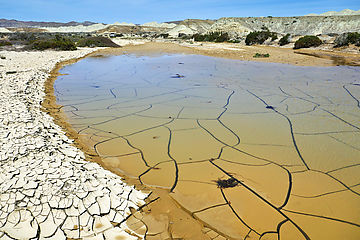
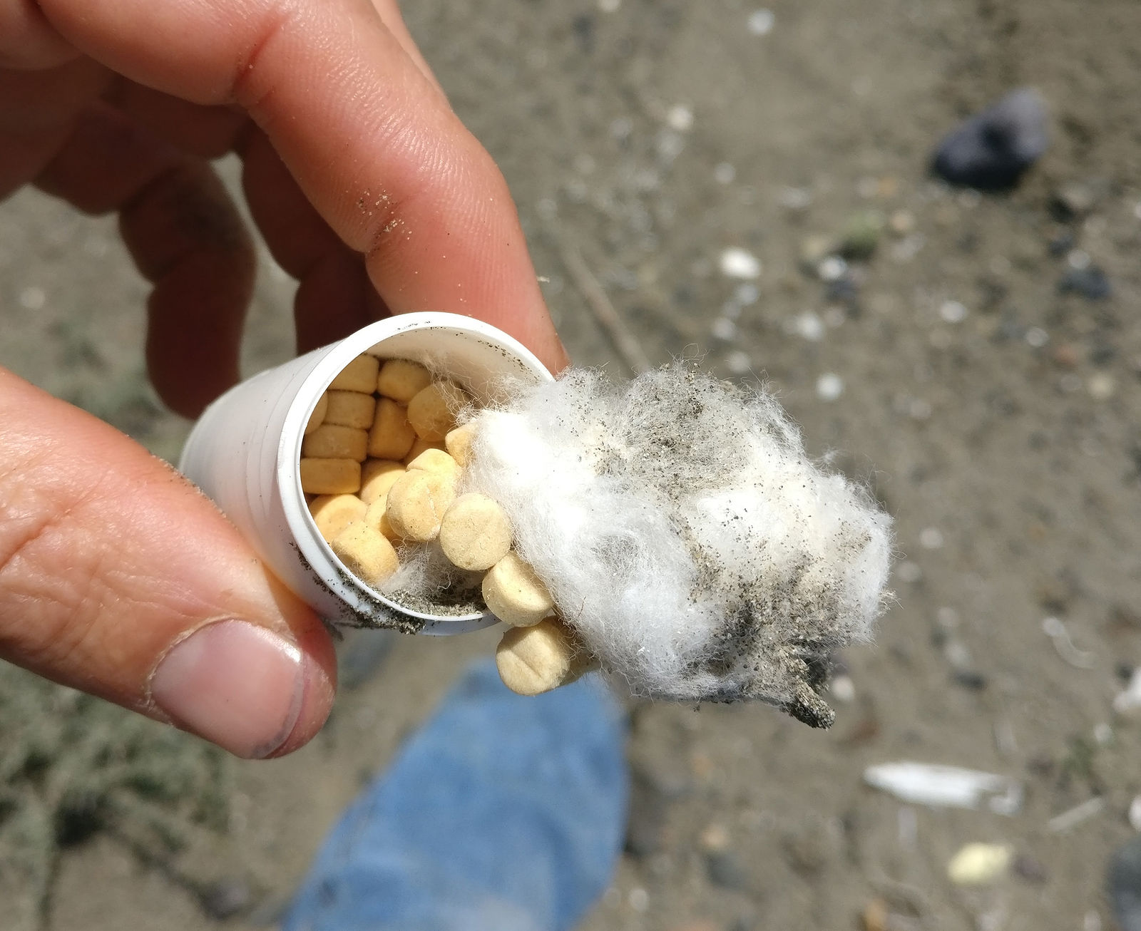
The next beach is just southeast of the Punta Quebrada fishing camp. Being in sight of houses doesn't make this place very private. And the road ends in mud which prevented me from driving all the way to the beach. But this slowly drying mud held my interest with its compelling irregular pattern of cracks. (GPS:27.7297,-114.9874)
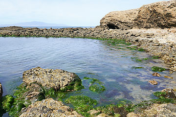
   Punta Eugenia
Here are the rocky tidepools of Punta Eugenia, at the very tip of the Vizcaino peninsula. (GPS:27.8538,-115.0727)
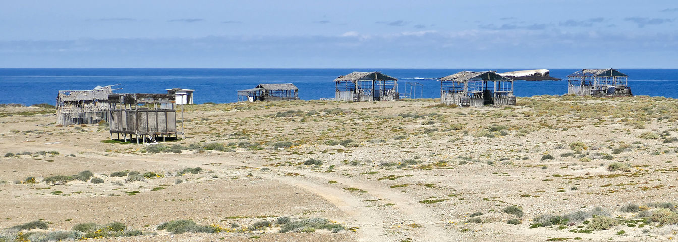
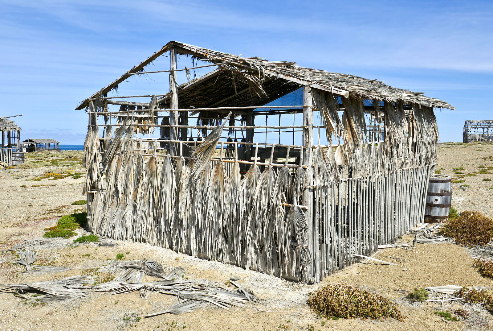
  Punta Falsa
The road continues a little farther, around the corner to the right, passing Punta Falsa where these abandoned cabanas made of wood and palm fronds are slowly decaying. It looks like care was taken in building them at some point, but now they are slowly blowing apart. Some are still padlocked shut, despite the gaping holes in the walls. I wonder what's the story here? (GPS:27.8608,-115.0557)
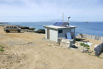
   Punta Puerto Escondido
The road ends at Punta Puerto Escondido, where there is a final vigilancia shack. (GPS:27.8564,-115.0419) I peeked around the corner, looking east along the north shore of the Vizcaino towards Malarrimo.
  North Shore of Vizcaino
However, there is no road east along the next six miles of the rocky north shore. So, to continue my tour, I had to retrace my steps to Bahía Tortugas, and then head north from there.
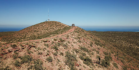
On the way I made one quick detour to check out the view from some communication towers I spotted. (GPS:27.7801,-115.0004)

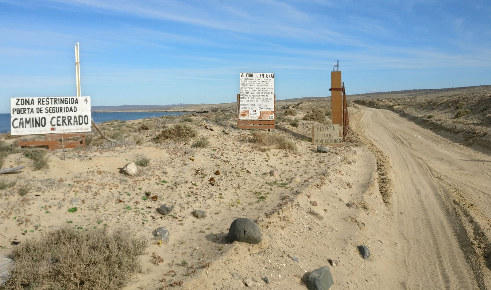
Returning to the north shore near El Chevo, I made my way east to the fishing village of Malarrimo. I had intended to keep wandering east to see if I could make it all the way to Malarrimo Beach (the famous trash beach), but these signs made it clear that the vigilancia did not want tourists driving through here without their explicit permission. (GPS:27.7952,-114.7184)
Oh well... I did my best to see most of Vizcaino. With all the vigilancia, I probably won't be drawn to do much more camping around here in the future.
( end of part 8...)
|
|
|
|
|
04-20-2019, 06:52 PM
|
#10
|
|
Senior Member
Join Date: Apr 2007
Location: SF Bay Area, CA
Posts: 1,289
|
As always, thanks for sharing!! I'm counting the days until I take off for SA and spend some time in Baja.
__________________
Phil
- 2005 EB50 6.0PSD - SMB 4x4
|
|
|
|
|
|
 Posting Rules
|
You may not post new threads
You may not post replies
You may not post attachments
You may not edit your posts
HTML code is Off
|
|
|
|
 » Recent Threads
 |
|
|
|
|
|
|
|
|
|
|
|
|
|
|
|
|
|
|
|
|
|
|
|
|
|
|
|
|
|
|
|
|
|


 AWOL
AWOL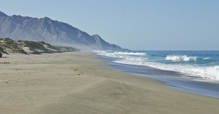


 Linear Mode