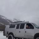
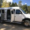
All the years Ive lived in Oregon Ive wanted to take this trip and finally did this Memorial Day weekend. 853 miles RT from Portland. Left on Friday morning, back on Monday evening. About 5 1/2 hrs to Burns, where we stayed at a decent Best Western-type Inn.
Our Garmin track:

Really enjoyed driving that Route 20 to Burns. Such big country! The next couple of days we drove 30 miles to the Malheur National Wildlife Refuge. Gorgeous grounds and glad to see it all cleaned up after the big hoopla out there. You can get a CD auto tour from the nature store, great for guiding us through the Refuge. Its quite a few miles, so we broke it into two separate days. The weather was nice and cool and we had a couple of rain and lightening storms while we were out. Whew! Ive never seen anything like that gigantic sky lighting up with no buildings, no mountains, nothing to obstruct your view.

Word of caution on traveling the Refuge road after a spate of recent rain storms. Every river (the Blitzen mostly), every creek, every marsh, every field was drenched to the gills. Who knew the desert could transform like that? The little gravel refuge road, in some spots barely wider than the van, sat up proud of the water on either side by only a couple of feet. I tried not to rubberneck too much for fear of winding up in the drink. Of course, there were those obstinate souls who insisted on driving through the wrong way. Since I didnt care to test the flotation capabilities of a 7500lb van, I mostly made their little cars go around me. Maybe your Subaru floats?


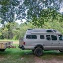
We saw the most spectacular birds in colors Ive never seen. What a place! We got some great photos, though the mosquitoes were swarming like mad. So glad to have a van for easy access to our food, take a rest or potty break, and not have to go out and feed my body to those skeeters. We returned to Burns via back roads up to route 78. Great loop, great scenery.

Some great taxidermy of Refuge species in the museum:

The second day, after traveling the bottom half of the Refuge, we visited Frenchglen, a town with a bustling 1916 hotel in the middle of nowhere. They were filled up for the weekend with birders from all over.

After Frenchglen, we traveled the couple of miles up the Steens Mountain Loop Road. Unfortunately, the gate to the top was locked due to still-snowy conditions. So we checked out the Page Springs campground instead. One of the nicest BLM campgrounds Ive seen. At $8 a night/$4 for seniors, you cant beat it. Water and electric hookups and lots of nice trees to keep out the desert sun.

Saw this at the Hot Springs Campground in Crane:


In closing, I cant say enough good things about my Garmin In-Reach Explorer+. I love the way it tracks without a glitch and I always know where I am on the map. Ive dedicated my older IPad to mapping and enjoy the real-time tracking. So easy to zoom in on the IPad.

But Ill also recommend the companion to an app lots of folks here use, You Need a Map. I downloaded their Scenic Maps app Western USA to the IPad so I can both plan on it ahead and use it as a highly detailed map in the field. Im really impressed with the level of detail and it got us going right at several gravel intersections where it wasnt at all clear which way to go.

We sure enjoyed this trip. Though we really wanted to see the Alvord Desert on the other side of Steens, it would have added several hundred miles to an already mile-stuffed long weekend. Next time!

.


 PhoTo
PhoTo


 2008 GMC 3500 SMB

 Linear Mode