For Baja adventurers, this is exciting news -- the makers of the until recently out-of-print (but essential)
Baja Almanac have finally released a new (3rd) edition!
Quote:
- Larger Size 10.75 wide x 15.25 tall[/*:m:3dfhnceo]
- Printed on 70lb Paper with Matte Finish for a crisper, more defined presentation[/*:m:3dfhnceo]
- Adjoining Map Overlap each map displays an overlapping segment of adjoining map pages[/*:m:3dfhnceo]
- Updated Land Routes & Cultural Features[/*:m:3dfhnceo]
- Complete Indexes, Mileage Chart and Primary Route Distance in both miles & kilometers[/*:m:3dfhnceo]
|
They have a sample image here:
http://www.baja-almanac.com/wp-conte...lmanac_f22.pdf
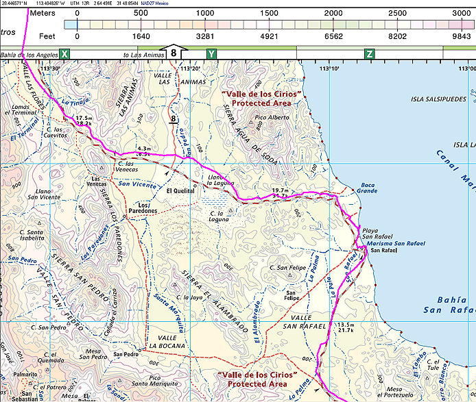
Here's my GPS track from a year ago plotted on this sample map (using OziExplorer). The real latitude/longitude grid and tick marks are nice, but the map still doesn't seem perfectly calibrated with reality. On this image, the road south from San Rafeal has improved, but still doesn't exactly match my experience.
In any case, I just ordered my copy!
-- Geoff


 Linear Mode